Tag Archive for: Conservation

USAID Report

A key recommendation by a USAID report that was released in June and titled “Emerging Technology and Practice for Conservation Communications in Africa” is for international development agencies to institutionalize good practice in the use of ICTs for Conservation. The report noted that while the conservation community has a wealth of experience in harnessing ICTs and communications among its many members, the distribution of this expertise is uneven.

Read more

Photo credit: Sustainable Futures

980 million people traveled internationally in 2010, a 4% increase over the previous year, and forecasts expect 1.6 billion tourists by the year 2020. Travel & Tourism as a sector accounts for 258 million jobs globally, and provides crucial opportunities for investment, economic growth, and fostering cultural awareness.  Tourism can also be a powerful tool for tackling major challenges such as conservation and poverty alleviation.

But how do environmentally and socially conscious travelers navigate the complex differences between ecotourism, sustainable tourism, socially responsible tourism and the other myriad forms of traveling responsibly?

Ecotourism vs Sustainable Tourism

Industry consensus agrees ecotourism is more focused on ecological conservation and educating travelers on local environments and natural surroundings, whereas sustainable tourism focuses on travel that has minimal impact on the environment and local communities. Ecotourism is a form of tourism, or a category of vacation similar to beach, adventure, health, or cultural, while the concept of sustainability can be applied to all types of tourism.

As established by The International Ecotourism Society (TIES) in 1990, ecotourism is “Responsible travel to natural areas that conserves the environment and improves the well-being of local people.” Another widely cited definition of ecotourism is “purposeful travel to natural areas to understand the culture and natural history of the environment; taking care not to alter the integrity of the ecosystem; producing economic opportunities that make the conservation of natural resources beneficial to local people.”

The Global Sustainable Tourism Council (GSTC) is a global initiative dedicated to promoting sustainable tourism practices around the world. GSTC and its global members of UN agencies, global travel companies, hotels, tourism boards and tour operators follow the Global Sustainable Tourism Criteria. The 23 criteria focus on best practices to sustain natural and cultural resources, maximize social and economic benefits for the local community, and minimize negative impacts to the environment.

Currently there is no internationally accredited body charged with overseeing the standards, monitoring and assessment, or certification for the ecotourism or sustainable tourism industries. Without an established standard it is easy to be confused by organizations that greenwash services and offerings as “environmentally friendly.” Others argue that ecotourism is an oxymoron, as travel implicitly entails activities that are detrimental to the environment. Planes, trains and automobiles use harmful fossil fuels that emit CO2, and forestland is often cleared for roads and railways.

Ecotourism and Sustainable Tourism in Action

Photo Credit: Visit Costa Rica

Costa Rica was a pioneer in ecotourism and exemplifies how tourism can be a key pillar of economic development policy. Costa Rica is now the premiere destination for ecotourism, and in 2010 tourism contributed 5.5% of the country’s GDP. Jordan serves as another model of successfully integrating conservation and socio-economic development. Ecotourism generated $2.1 million in 2010, and Jordan’s Royal Society for the Conservation of Nature has received several global awards for its success in alleviating poverty and creating employment for local communities, in combination with integrating nature conservation.

Myriad sites offer options for tours and hotels that cater to a more environmentally friendly and sustainable type of traveling experience. The New York Times travel section allows viewers to search potential destinations using ecotourism as a criteria, and Condé Nast Traveler highlights Ecotourism and Sustainable Travel under Expert Travel Tips.

The Earthwatch Institute, organizes trips where travelers work alongside scientists and explorers on field expeditions and Sierra Club’s travel arm Sierra Club Outing allows environmentalist to learn something on vacation and inflict minimal harm on the surrounding environment.

At the industry level, hotels and resorts are taking on sustainability commitments that focus on recycling, decreasing water and energy usage, reducing greenhouse gas emissions,and environmentally friendly design. Many in the industry show a commitment to a holistic approach to sustainability which includes  the construction of Leadership in Energy & Environmental Design (LEED) certified buildings, providing eco-friendly and organic food and wine selections, and rewarding guests who make “green choices.” Marriott, which boasts 2,800 hotels worldwide, offers guests hotel points or vouchers for the hotel restaurant should they choose to not having linens and towels washed daily.

Understanding the difference between sustainable tourism and ecotourism educates travelers on the significant impact their travel decisions have on the environment, economy and local communities they visit. Participating in sustainable tourism, or more specifically ecotourism vacations, means travelers can contribute to development and conservation efforts, while enjoying themselves on vacation.

Photo Credit: TV Pro Gear

An initiative being co-led by Conservation International (CI), the Council for Scientific & Industrial Research (CSIR), South Africa and the Earth Institute (EI), Columbia University, has been launched with a grant from the Bill & Melinda Gates Foundation.

The Africa Monitoring System (AMS) tool will track, monitor and diagnose agricultural productivity, ecosystem health, and human well-being in African landscapes with near real-time data to better understand the opportunities and trade-offs of increased agricultural production. The system will provide tools to ensure that agricultural development does not degrade natural systems and the services they provide, especially for smallholder farmers.

The three-year $10 million dollar grant was announced by the co-chair of the foundation, Bill Gates in Rome at the 35th Session of the Governing Council of the International Fund for Agricultural Development (IFAD) held in February. The grant lays the foundation for a new integrated monitoring system in five regions of Sub-Saharan Africa, including Tanzania, Ghana, Ethiopia, and two other countries to be determined, where agricultural intensification is targeted to meet the needs of Africa’s growing population.

Dr. Sandy Andelman, a vice president of Conservation International who will serve as Africa Monitoring System executive director said, “We face this enormous challenge that boils down to this key question: How are we going to feed nine billion people on the planet without destroying nature, especially in the face of climate change which in itself brings vast uncertainty. The answer is that we can no longer afford to make decisions without really seeing the full picture of what is happening to the planet.”

The Africa Monitoring System (AMS)

The success of the system will depend on the accuracy and timeliness of the data collection process which will happen at multiple scales to create the most accurate possible picture. This will include

  • A household scale, using surveys on health, nutritional status, household income and assets;
  • A plot scale to assess agricultural production and determine what seeds go into the land, where they come from, what kind of fertilizer is used, what yield of crops they deliver, what happens after the harvest;
  • A landscape scale (100 km2) measuring water availability for household and agricultural use, ecosystem biodiversity, soil health, carbon stocks, etc.; and
  • A regional scale (~200,000 km2) that will tie everything together into a big picture, to see the scales at which agricultural development decisions are made.

The raw data will be fully accessible and synthesized into six simple holistic indicators that communicate diagnostic information about complex agro-ecosystems, such as:  availability of clean water, the resilience of crop production to climate variability or the resilience of ecosystem services and livelihoods to changes in the agricultural system. The near real-time and multi-scale data will be pooled into an open-access online dashboard that policy makers will be able to freely use and customize to inform smart decision making.

“Rather than having a set of data over here for one issue, and other sets of data over there for other issues, what this system will essentially do is assemble the different puzzle pieces into one clear image that will allow decision makers to transparently see the parts and their sum in one centralized location”, Andelman explained.

CI Chairman and CEO Peter Seligmann praised the grant as a landmark moment in conservation which would inspire others.  “We are honored to be entrusted by the foundation to shepherd their largest investment to date in examining the relationship between agriculture and the environment, and I could not be more encouraged or appreciative for their leadership, concluded Seligmann.”

CI, CSIR and Earth Institute will collaborate with governments, other non-governmental organizations, the academic community, the private sector and key international partners over the next three years to design and implement the Africa Monitoring System. This period will represent Phase 1 (three years) of a three-phase process (10-15 years) to create an Integrated Global Monitoring System for Agriculture, Ecosystem Services and Human Well-Being, and developers expect to mobilize additional resources to leverage the Foundation’s investment.


New Agriculturist
reports that International Small Group & Tree Planting Program (TIST) has begun to train over 50,000 farmers in eastern Kenya on carbon trading. TIST reports that it has planted over six million trees in Kenya. TIST is involved in tree planting ventures across Africa and Asia.

In this particular initiative, TIST acts as a broker between farmers with trees and individuals or companies who wish to offset their carbon footprint. TIST trains locals to track farmers’ trees using hand-held computers and GPS devices. The trained locals record the location, number, size, species, and take photos that are uploaded and posted online. Three to six months after planting, a tree is eligible for carbon credits that earn farmers 1.50 shillings (US $0.02) per tree annually.

Besides monetary benefit, the tree planting also provides farmers more secure water storage during rain and drought and aid soil health and fertility. TIST is thrilled with the results of this initiative, which are leading to more sustainable land management practices.


Save the Elephants is celebrated for its conservation work in Kenya, Congo, Mali, and South Africa. The four pillars of Save the Elephants are research, protection, grassroots, and education. Each of these pillars is taken seriously in a comprehensive way, keeping in mind that the ultimate approach to conservation is through local knowledge and understanding the elephant’s perspective.

Save the Elephants has used tracking technology since the mid-1990s. The Elephant Tracking Project displays movement patterns and corridors by using ESRI software that verifies GPS data. The tracking device also allows for a Quick Response Unit that notes any disturbances that might signal poaching. An integral part of Save the Elephants’ tracking and research is based off of data collected by GPS/GSM collars that send text messages every couple of hours that contain details on their location, air temperature, and humidity. Currently there are over eighty collars in rotation.

Tracking patterns can be viewed in Google Earth on a moving 3D  backdrop of satellite photos provided by Digital Globe. On top of these tracking images of migratory patterns, stories and events are attached for interaction and educational purposes. Through such tracking, researchers are better able to understand why elephants do what they do and the complex social structures in which they live. Researchers can infer on how the relationship between human settlements and water resources affect elephant movements. By tracking these patterns, protected corridors have been established.


Photo Credit: Save the Elephants


An interesting project that Save the Elephants has taken on is geofencing. Traditional fences can be very costly and often ineffective in deterring bull elephants from raiding small-scale agriculture near human settlements. Geofences send an SMS message to an animal management team when a collared elephant passes through it. The team then can chase the elephant out of the fields and train it through negative reinforcements not to pass through the fence again. The program is being refined to teach elephants where they can’t go and to inform farmers of potential night-raids.

Another project is called SEARS (Spatial Economics and Remote Sensing of Elephant Resources). The organization created a vegetation map of Samburu to monitor migration patterns and the distribution of individual species of vegetation. Through layering the data, researchers can note the size and nutritional value of the vegetation. The goal of this project is to better understand why elephants migrate according to specific corridors and between specific regions. Save the Elephants notes how drastically migratory routes change when there are abrupt transformations in weather norms.

Save the Elephants rejoices in the explosion of communications and technology that allow the outside world to experience remote areas. The organization regularly engages with schools and provides media on their webpage.

Data Basin, an online system, is quickly growing in popularity among practicing educators and community groups that wish to tell compelling stories with graphics. Data Basin connects users with spatial datasets, tools, and expertise through a user-friendly platform where “individuals and organizations can explore and download a vast library of datasets, upload their own data, create and publish analysis, utilize working groups, and produce customized maps that can be easily shared.”

In a presentation on its potential, Jame Strittholt, Data Basin’s founder and Conservation Biology Institute‘s Executive Director called it Google Earth on steroids meets Facebook, allowing groups to communicate with each other by integrating conservation data, mapping, and people. The site contains groups for specific topics and issues and centers for targeted geographies. The core functions of Data Basin are free and a fee-based consulting service is available for those who wish to take full advantage of its features or store significant amounts of data. Currently a great variety of biological, physical, and socioeconomic data is available. Maps can be kept private, within groups, or open to the public.

Data Basin was created out of the need for a central access point for environmental conservation related datasets that people can explore. The tools are easy to understand and use, making it an excellent resource for nonprofessionals or those unfamiliar with ArcGIS. Data Basin was implemented by the Conservation Biology Institute in partnership with ESRI.

Photo Credit: MarineBio


By some accounts tourism is the world’s largest industry, accounting for more than 10% of total employment. Tourism can have a negative impact on the environment by leading to the degradation of habitats and landscapes, depleting natural resources, and generating waste and pollution.

As a response to these concerns, ecotourism has grown in popularity because of its emphasis on being ecologically and socially conscious by raising awareness and support for conservation and local culture. Responsible ecotourism includes programs that minimize the adverse effects of traditional tourism on the natural environment and enhance the cultural integrity of the local people. Ecotourism has great potential for the developing world as communities come together and get involved, enforcing their own standards for sustainability.

So what is ecotourism 2.0? Ecotourism 2.0 seeks to fill the gaps that exist in ineffective organizing structures of ecotour communities. There are three main characteristics of ecotourism 2.0:


1. Engagement and Education – tourism doesn’t have to be passive and there can be a take-home message

2. Social Media – access and communication of information

3. Radical Transparency – clear organization within communities and with their visitors

Social media has thoroughly changed marketing techniques, now “people aggregate themselves around causes and products they believe in and age, sex and other demographic information is more and more irrelevant as this new media environment takes over.” It also allows for easy access to specific information and advice from locals, extending the experience beyond a vacation with updated news and reminders of key concepts.

Let’s look at successful social media campaigns:

LaosEcotourism Laos‘s website has Google Groups for donor organizations, government agencies, NGOs and the private sector to exchange information on current projects and issues relating to ecotourism development in Laos. The website allows for transparency and easy access to information and recommendation for visitors.

IndiaEcotourismkeralam.org provides access to information, specifically contact information for visitors to Kerala, India. Kerala is considered one of India’s most unspoiled corners prone to forest clearing.

KenyaEco Tourism Kenya is a multifaceted forum with updates and links to everything related to sustainable tourism.

Lebanon – This Baldati community is an ecotourism e-community for public announcements in the field.


How can ICTs be used to combat climate change? Stan Karanasios’s paper entitled “New & Emergent ICTs and Climate Change in Developing Countries” outlines emerging ICTs in 3 steps:

  • monitoring of climate change and the environment
  • disaster management
  • climate change adaptation
Excerpts from the paper outline uses of ICTs for climate change:

Monitoring of climate change and the environment

For developing countries to better understand their local climate and be able to anticipate climate change impacts, they must have adequate local and national observation networks, and access to the data captured from other global and regional networks. 

Types of technology include:

  • satellite systems
  • wireless broadband technologies
  • wireless sensor networks (WSN)
  • mobile phones
  • hand-held devices 
Examples of environmental monitors:
  • Rainfall and Landslide- In hilly regions of western India, SenSlide, a distributed sensor system, predicts rather than just detects landslides. Landslides occur frequently, often during the monsoon when rain causes significant damage. SenSlide makes use of WSN and strain gauges, providing data to a network.
  • Fire- In South Africa, FireHawk, a forest fire system of cameras with zoom lenses and microwave transmitters and receivers was implemented in mountainous and extreme temperate locations. The system automatically detects fires, even at night, limiting the impact of damage.
  • Flood- In Honduras, a WSN for flood monitoring was developed that was able to withstand river flooding and the severe stromes causing the floods, communicate over a 10,000 km river basin, predict flooding autonomously, and limit cost, allowing feasible implementation of the system.
  • Impacts of Agriculture- In India a WSN-based agriculture management system named COMMON-Sense Net, was deployed to support rain-fed agriculture and provide farmers with environmental data. Wireless sensors were deployed in geographical clusters, each with one base-station that was connected to a local server via a Wi-Fi link and organized in groups, each corresponding to a particular application, such as crop modeling, water conservation measures, or deficit irrigation management.

Disaster management

Responding to natural disasters in a timely and effective manner has emerged as an important climate change theme particularly in developing countries; where in addition to the immediate crisis vulnerable communities suffer excessively from the secondary post-disaster effects that compound the tragedy. In many cases, the existing telecommunication infrastructure will be significantly or completely destroyed by an extreme weather event, and hence rapidly deployable networks and other communication services need to be employed for disaster relief operations. 

Communication Methods:

  • Emergency Communication Systems- In Bangladesh an Integrated Information and Communication System is underway which will use satellite, wireless broadband, mobile phones and community radio services strengthening communication links between rescue and relief units and Emergency Operation Centers (EOC).
  • Rapidly Deployable Communications
  • Social Networking- During Typhoon Ondoy in the Philippines in 2009, local volunteers organized and disseminated information online through websites such as Facebook and Twitter. Organizations and affected people used these sites for timely reports concerning the extent of damage, to provide information on the resources required tand to allocate relief resources.
  • GIS & Other Information Systems- Visualize high risk zones; evacuation routes, shelters and the catalogue of available resource and their proximity
  • Early Warning Systems- satellite radio, mobile phones, cell broadcasting system, the web, WSNs, and CAP (common alerting protocol) can be coupled with climate data for immediate and short/medium/long-term warnings to minimize harm to vulnerable communities.

Disaster Management Project Example: Project DUMBO

Mesh Networks and Disaster Response in Thailand DUMBO,  a project initiated by  the Asian Institute of  Technology Internet Education and Research Laboratory, developed and tested asystem for response to emergency scenarios in Thailand . Making use of the concept of wireless mesh networks, DUMBO uses lightweight  portable mobile nodes  to  broaden  coverage and penetrate deep into  areas  not  accessible by  roads  or where the telecommunication  infrastructure  has  been  destroyed.  During  the trials in  Thailand, laptops  were carried on elephants to  extend thewireless  mesh  network  coverage.  On the networking  side,  the solution  utilised hybrid Wi­Fi and  satellite connectivity.  The second application component involved sensors, which allowed for  readings of  environmental data  such  as  temperature,  humidity,  pressure, wind­speed,  wind­ direction,  rainfall and  CO2.  The third application component involved facial recognition software that allowed rescuers to compare facial images captured from the site to the collection of known faces. This is one of a few systems in developing countries that  make use of  emergent  technologies  and  combine communications with integrated disaster applications

Climate change adaptation

To cope with current and future climate stress, communities – particularly those most vulnerable to developing countries – must build their resilience, including adopting appropriate technologies, while making the most of traditional knowledge, and diversifying their livelihoods. For instance, monitoring networks can inform habitat location (provide information to house communities away from a flood or landslide in prone areas), better agriculture (based on informed climate information or water allocation) and provide early warnings, amongst other applications. Mobile technology should be scaled-up for adaptation.

There is a lot of room for growth in developing ICTs for adapting to climate change through collecting, analyzing and disseminating information particularly in space-based systems, GIS, WSNs, wireless broadband technology, mobile technology, and soft technologies such as Web-based tools. By doing so, bottom-up local coping strategies will be encouraged.


Last week The Guardian announced that we’re now able to see the Amazonian rainforest as never seen before. A group of scientists, using LIDAR (Light Detection and Ranging) took images from a plane called the Carnegie Airborne Observatory. The images were taken by bouncing a laser beam off of the forest canopy at 400,000 times per second. The resulting images are vibrant, showcasing variation in biodiversity at unprecedented detail. The new technology will be used to manage the ecosystem, monitoring for signs of deforestation and degradation.

Biofuels… Good or Bad Idea? They’ve received positive hype from non-profits, corporations, and individuals only to be scorned by some environmentalists, economists, and other groups.

Photo Credit: GSMA

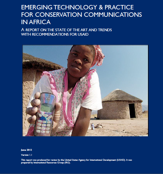
A common barrier facing rural regions is a lack of access to a reliable power supply. Being off the grid limits the ability to take advantage of information and communication technologies (ICTs) that could provide economic gain and increase quality of life. What’s the use of a mobile phone with innovative software applications if it can’t be recharged?

One popular answer for off-grid communities is building biofuel-based facilities that are run off of renewable resources. Biofuel is simply energy released directly or indirectly from living or recently living organisms. Wind and solar power are included, but fossil fuels are not because they are embedded in geological formations and nonrenewable.

Biofuels have been used for over a millennia, such as the simple method of burning wood for fuel. Other traditional methods used throughout the developing world include using conventional feed such as maize, wheat, sunflowers, and switchgrass for combustion that are then used for cooking, heating, and lighting.

Modern bioenergy used for fuel can be more complex, taking advantage of residue, bacteria, and other organic components of waste that produce a higher value energy carrier, meaning they are more efficient and versatile than traditional methods. The most common method for converting biomass into fuel is by combustion that generates heat. Other known methods include gasification, extraction, and fermentation (used for converting starch or sugar crops into ethanol). In recent decades ethanol and other forms of biofuels have increased in popularity due to the fluctuation of oil prices, carbon emission, and as an option for rural development.

Photo Credit: Prof. Thomson Sinkala, Chairman, Biofuels Association of Zambia

So are biofuels the answer for connecting rural communities with the greater world? Let’s weigh some notable advantages and disadvantages:

PROS

+ Biofuels are locally harvested, decreasing transportation costs.

+ The harvesting and processing of biofuels creates local jobs.

+ Biofuels are renewable.

+ Plants used for making biofuels can be grown on marginal lands.

+ The cost of renewable energy technology is falling, making energy projects more affordable and easier to maintain.

CONS

Not all biofuels are sustainable.

Traditional forms of bioenergy can cause unpleasant consequences such as deforestation.

Traditional biofuels are highly inefficient when compared to fossil fuels and nuclear energy.

Biofuels derived from vegetation require a lot of water, adding pressure to an already limited and fragile source.

Instead of using limited arable land for food production, it’s used for growing biomass that can be improperly fertilized, further harming water systems.

It can negatively impact life-cycles, species health, and biodiversity.

So are biofuels a good or bad solution for rural areas? The decision must be made at the local level; weighing costs, benefits, and sustainability. Below are examples of successful projects where biofuels are used to supply power.

Indonesia–  Instead of depositing livestock waste in waterways, it  is processed in a biodigester, creating biogas used by the local population.

ChinaRice ‘straw’, the stem and leaves left behind after harvesting to be burnt can be mixed with an alkaline solution to create biogas.

Mali– Jatropha, a poisonous weed used to keep away grazing animals thrives in marginal soil is used to power generators.

KenyaSolar and hydro energy is used for a power center that provides access to Internet and mobile phones for local farmers.


Copyright © 2020 Integra Government Services International LLC