Tag Archive for: disaster response

Photo credit: www.vaccinenewsdaily.com

With the rainy season off to an early start in Haiti this spring, can technology help stave off the rising cholera epidemic?

That’s what several international aid and health organizations are considering now that the advantages of ICT — innovation, efficiency, fast-response time — are needed to meet the impending rainy season which promises to bring flooding and ultimately more cases of cholera.  Since the earthquake in 2010, more than 530,000 Haitians have fallen ill with cholera, and more than 7,000 have died — staggering numbers when considering the amount of international aid and health projects that have descended upon the country within the past two years.  ICT in all of its forms and all that it enables — low-cost mobile devices, open data and access, social media — could improve the response time and efficiency of health initiatives in the cholera crisis if properly implemented.

One example of how ICT is already being utilized to prevent more cases of cholera is a new vaccine campaign by GHESKIO, a health organization based in Port-au-Prince, Haiti, in collaboration with Partners in Health, a non-profit healthcare organization that is well known for their efforts against the spread of cholera.  In order to identify recipients for the vaccines as efficiently and quickly as possible within a country where travel is difficult, community health workers went door-to-door collecting information about the potential recipients via smartphones. The information was then aggregated into a database to locate and distribute the vaccines to the 100,000 chosen recipients — a process that has just begun after a series of delays.

Utilizing mobile technology to combat the spread of cholera is not a new concept to Partners in Health.  In a campaign started just last year, community health workers have been using specially programmed phones to help track information about cholera patients in isolated communities throughout Haiti’s Central Plateau – an important step in gathering up-to-date infection data that could prevent more deaths.  “Receiving real-time cholera information from community health workers is crucial,” says Cate Oswald, Partner in Health’s Haiti-based program coordinator for community health.  “We need accurate and up-to-date reports in order to best prevent more cases and respond to quick spread of the epidemic.”

Social media has also played a large role in detecting and tracking the incidence of cholera outbreaks.  A study released in January by the American Journal of Tropical Medicine and Hygiene reported that Twitter actually provided data that was faster and more accurate in some cases than traditional methods in tracking the cholera epidemic.  Not only does social media provide a fast response time, it “is cost-effective, rapid, and can be used to reach populations that otherwise wouldn’t have access to traditional healthcare or would not seek it”, said Rumi Chunara, a research fellow at HealthMap and Harvard Medical School in the US, and lead author of the study.

Image from haiti.mphise.net

HealthMap, an automated electronic information system for monitoring, organizing, and visualizing reports of global disease outbreaks according to geography, time, and infectious diseases, has been an important tool in helping inform Partners in Health and other health organizations about the spread of cholera in Haiti.  Not only does HealthMap track the spread of cholera, it also identifies new safe water installations, health facilities, cholera treatment centers, and emergency shelters.

MSF doctor kneels next to young girl with cast on her leg

Photo: MSF

By Médecins Sans Frontières

As a project manager for MSF (Médecins Sans Frontières/Doctors Without Borders), a medical emergency humanitarian agency, I attended this year’s South by Southwest (SXSW) festival in Austin, Texas, in the company of a friend and collaborator from Google who is involved in crisis mapping. We gave a presentation on some mapping work we had done together, and inevitably we discussed the differences and similarities in our geek (high-technology) and primitive fieldworker (humanitarian) cultures.

The two cultures are, on the face of it, rather distinct.

Geeks live in highly connected environments, usually urban, surrounded by technological infrastructure straight from the most outrageous science fiction of decades past. They inhabit an intellectual world of abstractions: math, code, logic, creativity, and business; while their physical existence is supported by a seamless layer of luxury and connectivity. The food, and the coffee, is good.

Humanitarian fieldworkers live a variety of environments from luxury hotels or palatial mansions to mud huts or tents, with variable connectivity, but almost always with constraints. Even in the most modern of African or South Asian capitals the technological infrastructure is often wobbly; there may be high-speed internet but it usually features random periods of downtime. In the mud hut scenario, internet and telephone use generally involves a satellite rig, great expense, and substantial cursing at the fiddly configurations and on-again-off-again unreliability. Our lives are never far abstracted from the constant effort required to enable working conditions, and the intensely pragmatic work of solving immediate problems. That patient is in danger of dying NOW, that refugee camp needs clean water NOW, and if we don’t get the car fixed in the next few hours we’ll be spending the night by the riverbank eating dry emergency ration biscuits. Most of us have at one time or another shared a single broken-down laptop with several people, a leaky thatched roof over a mud floor, and a plate of sandy, oily rice that is as good as we’re going to get for dinner.

Despite these disparate viewpoints (abstraction vs. immediate physical pragmatism) and differing ecological niches (urban café vs. mud hut) there is an unexpected similarity; primitive fieldworkers and geeks share a culture of problem-solving. Nothing makes a geek happier than a tough problem that gets all the neurons firing, and nothing makes a fieldworker happier than a serious emergency that gets the adrenaline flowing (if that sounds callous, in our defence it’s not the suffering that we enjoy, but the chance to make a real difference with our work).

At SXSW we had the chance to share that cultural crossover with a broad audience of geeks, fieldworkers, and an assortment of others, all of whom shared an interest in the intersection of humanitarian work and technology.

My main take-home message was: we are not alone.

We humanitarians tend to take pride in our ability to deal with problems by stretching our ingenuity and using only what is available in the field. My friend from Google was astounded at what we do with spreadsheets, saying “I didn’t think that this could be done without software coding capacity”. We use spreadsheets as databases, stock management systems, maps, payroll systems, and sketchpads. This is, perhaps a strength but I am beginning to realize that we take it too far. There is an enormous community out there in the world, with increasingly robust electronic links to even the most remote field locations, who can help us. Open source code can be written to address problems that we would normally tackle with tortuous repurposing of spreadsheets; there are incredibly talented programmers delighted to donate their efforts, especially to interesting problems. Informal slums can be mapped by volunteers, either people who once lived in the country or even by people who have never been there simply hand-tracing satellite imagery. The astounding success of the Ushahidi project (follow the link to read about an open-source crisis mapping project that started in Kenya to assist people during electoral violence and has since been used around the world, including Washington DC, to map emergencies) shows the power of crowdsourcing or distributed voluntarism to assist people in crisis.

Humanitarians need tools and information, particularly during crises. The tech world is bursting with possibilities to provide just that, often free of charge and with an astonishing level of professionalism. I hope that this meeting of cultures continues to deepen and that the early promise of these innovations translates to real benefit to the populations in crisis that we serve.

Ivan Gayton

Ivan Gayton is a project manager with Médecins Sans Frontières, currently working in Nigeria. During the Haiti cholera outbreak in 2010, he worked together with a team from Google to develop tools to map the outbreak using freely available software (Google Earth). He and Google’s Pablo Mayrgundter continue to work on an open-source epidemiological mapping tool in their scant spare time. Other than an interest in seeing further cultural cross-pollination between humanitarians and techies, Ivan has no conflict of interest, and no financial interests whatsoever in the matter.

This and many other MSF blogs are available at PLoS – Speaking of Medicine http://blogs.plos.org/speakingofmedicine/category/msf-2/

How can ICTs be used to combat climate change? Stan Karanasios’s paper entitled “New & Emergent ICTs and Climate Change in Developing Countries” outlines emerging ICTs in 3 steps:

  • monitoring of climate change and the environment
  • disaster management
  • climate change adaptation
Excerpts from the paper outline uses of ICTs for climate change:

Monitoring of climate change and the environment

For developing countries to better understand their local climate and be able to anticipate climate change impacts, they must have adequate local and national observation networks, and access to the data captured from other global and regional networks. 

Types of technology include:

  • satellite systems
  • wireless broadband technologies
  • wireless sensor networks (WSN)
  • mobile phones
  • hand-held devices 
Examples of environmental monitors:
  • Rainfall and Landslide- In hilly regions of western India, SenSlide, a distributed sensor system, predicts rather than just detects landslides. Landslides occur frequently, often during the monsoon when rain causes significant damage. SenSlide makes use of WSN and strain gauges, providing data to a network.
  • Fire- In South Africa, FireHawk, a forest fire system of cameras with zoom lenses and microwave transmitters and receivers was implemented in mountainous and extreme temperate locations. The system automatically detects fires, even at night, limiting the impact of damage.
  • Flood- In Honduras, a WSN for flood monitoring was developed that was able to withstand river flooding and the severe stromes causing the floods, communicate over a 10,000 km river basin, predict flooding autonomously, and limit cost, allowing feasible implementation of the system.
  • Impacts of Agriculture- In India a WSN-based agriculture management system named COMMON-Sense Net, was deployed to support rain-fed agriculture and provide farmers with environmental data. Wireless sensors were deployed in geographical clusters, each with one base-station that was connected to a local server via a Wi-Fi link and organized in groups, each corresponding to a particular application, such as crop modeling, water conservation measures, or deficit irrigation management.

Disaster management

Responding to natural disasters in a timely and effective manner has emerged as an important climate change theme particularly in developing countries; where in addition to the immediate crisis vulnerable communities suffer excessively from the secondary post-disaster effects that compound the tragedy. In many cases, the existing telecommunication infrastructure will be significantly or completely destroyed by an extreme weather event, and hence rapidly deployable networks and other communication services need to be employed for disaster relief operations. 

Communication Methods:

  • Emergency Communication Systems- In Bangladesh an Integrated Information and Communication System is underway which will use satellite, wireless broadband, mobile phones and community radio services strengthening communication links between rescue and relief units and Emergency Operation Centers (EOC).
  • Rapidly Deployable Communications
  • Social Networking- During Typhoon Ondoy in the Philippines in 2009, local volunteers organized and disseminated information online through websites such as Facebook and Twitter. Organizations and affected people used these sites for timely reports concerning the extent of damage, to provide information on the resources required tand to allocate relief resources.
  • GIS & Other Information Systems- Visualize high risk zones; evacuation routes, shelters and the catalogue of available resource and their proximity
  • Early Warning Systems- satellite radio, mobile phones, cell broadcasting system, the web, WSNs, and CAP (common alerting protocol) can be coupled with climate data for immediate and short/medium/long-term warnings to minimize harm to vulnerable communities.

Disaster Management Project Example: Project DUMBO

Mesh Networks and Disaster Response in Thailand DUMBO,  a project initiated by  the Asian Institute of  Technology Internet Education and Research Laboratory, developed and tested asystem for response to emergency scenarios in Thailand . Making use of the concept of wireless mesh networks, DUMBO uses lightweight  portable mobile nodes  to  broaden  coverage and penetrate deep into  areas  not  accessible by  roads  or where the telecommunication  infrastructure  has  been  destroyed.  During  the trials in  Thailand, laptops  were carried on elephants to  extend thewireless  mesh  network  coverage.  On the networking  side,  the solution  utilised hybrid Wi­Fi and  satellite connectivity.  The second application component involved sensors, which allowed for  readings of  environmental data  such  as  temperature,  humidity,  pressure, wind­speed,  wind­ direction,  rainfall and  CO2.  The third application component involved facial recognition software that allowed rescuers to compare facial images captured from the site to the collection of known faces. This is one of a few systems in developing countries that  make use of  emergent  technologies  and  combine communications with integrated disaster applications

Climate change adaptation

To cope with current and future climate stress, communities – particularly those most vulnerable to developing countries – must build their resilience, including adopting appropriate technologies, while making the most of traditional knowledge, and diversifying their livelihoods. For instance, monitoring networks can inform habitat location (provide information to house communities away from a flood or landslide in prone areas), better agriculture (based on informed climate information or water allocation) and provide early warnings, amongst other applications. Mobile technology should be scaled-up for adaptation.

There is a lot of room for growth in developing ICTs for adapting to climate change through collecting, analyzing and disseminating information particularly in space-based systems, GIS, WSNs, wireless broadband technology, mobile technology, and soft technologies such as Web-based tools. By doing so, bottom-up local coping strategies will be encouraged.

Mexico’s bouquet of distinct ecosystems features an assorted variety of species, making the country one of the most biologically diverse in the world. The gem of Mexico’s ecological abundance is in great danger due to the forces of climate change. The country’s coastal regions risk destruction from tropical storms. Other problems include heavy rains that increase flash flooding and pollution that dulls overall health. Environmental deterioration and degradation can be traced as a root cause of current social and economic problems in Mexico, especially as poverty is agitated by the effects of climate change.

In June 2011 the Association of Progressive Communications (APC) released “ICTs and environmental sustainability: Mapping national policy-making and climate change strategies“. In the report, the authors note the potential for ICTs in Mexico but warn of the overall disconnect between policy-making and climate change strategies. A critical piece missing is the general lack of communication infrastructure. The report cites a study that states that Mexico has the second lowest broadband density of all countries in the OECD and in comparison to other countries Internet is slow and expensive. In 2010, only 30 out of 110 million Mexicans had access to Internet. 

There is great potential for ICTs to litigate climate change in Mexico. The report points towards solutions for integrating ICT into the sector, noting the limited budget and lack of private investment in technology. Despite this, in 2010 Ericsson declared that they supported launching a public-private partnership for low-carbon solutions at the Conference of Parties to the United Nations Framework Convention on Climate Change held in Cancun (COP16).

Some proposed areas where ICTs can be introduced include:

  • tracking carbon footprints and using sensors to improve energy use efficiency
  • surveying water use
  • using geographic data for flood prevention
  • creating information dissemination and consultation systems to prevent and issue early warning in vulnerable situations such as natural disasters that can coordinate members of the National Civil Protection System
  • updating the national volcanological monitoring system
  • forming a surveillance system for land conservation

Photo Credit: iRevolution

The World Bank and Google have announced a collaborative agreement to use a free, web-based mapping tool called Google Map Maker that enables citizens to directly participate in the creation of maps by contributing their local knowledge.

The agreement is aimed at improving disaster preparedness and development efforts in countries around the world. Under the agreement, the World Bank will act as a conduit to make Google Map Maker source data, more widely and easily available to government organizations in the event of major disasters, and also for improved planning, management, and monitoring of public services provision.

The Importance of Local Knowledge

The most innovative component of this agreement, I believe, is the effort to blend scientific and local knowledge to solve local solutions. The need for integrating modern technology and indigenous knowledge into disaster management and prevention has long been overdue. While the technical capability of the new ICTs is huge, it also requires the mobilization of human resources, especially locally available human resources in tackling such disasters.

Just as the expertise of local citizens are being utilized to project their views in urban centers/cities through data-mapping, local knowledge, which is context specific, could be used to interpret the natural landscape of past natural disasters and using these indicators to help in forecasting future disasters. Studies have shown that local knowledge practices are cost effective, and incorporating them into scientific projects could help build local trust of the people. The use of local knowledge such as weather predictions, smells, sounds, cloud color, direction and types of wind, appearance and movements of insects, etc. could be tapped into, in disaster prone communities to help develop sustainable measures in interpreting early warning signals of natural disasters.

Google Map Maker

The Google Map Maker data includes detailed maps of more than 150 countries and regions, and identifies locations like schools, hospitals, roads, settlements and water points that are critical for relief workers to know about in times of crisis. The data will also be useful for planning purposes, as governments and their development partners can use the information to monitor public services, infrastructure and development projects; make them more transparent for NGOs, researchers, and individual citizens; and more effectively identify areas that might be in need of assistance before a disaster strikes.

The World Bank Institute (WBI) and the Global Facility for Disaster Reduction and Recovery (GFDRR) will manage the World Bank’s involvement in the collaboration, building on previous joint mapping efforts. For example in April 2011, members of the Southern Sudanese Diaspora participated in a series of community mapping events organized by World Bank and Google to create comprehensive maps of schools, hospitals and other social infrastructure in this new country via Map Maker technology.

Google has enjoyed a strong relationship with World Bank for many years. As indicated by the World Bank Vice President for the Africa Region Obiageli Ezekwesili, “Today’s technology can empower civil society, including the diaspora, to collaborate and support the development process. This collaboration is about shifting the emphasis from organizations to people, and empowering them to solve their own problems and develop their own solutions using maps.”

Read more on the agreement and possible partnership and collaborations with the World Bank offices.

Close up of a drop of water splashingThere’s been considerable debate lately about possible uses of information and communications technology for watershed management. Access to monitoring programs assists governments adequately manage and distribute water. Watershed management is critical for regional ecological health, clean water ability, disaster relief, and agriculture.

5 Noteworthy ICT Watershed Management Projects

  •  eGov features India’s Mahatma Gandhi National Rural Employment Guarantee Scheme (MGNREGS) that uses GIS mapping and GPS enabled mobile applications for planning and monitoring rainwater harvested agricultural land. The watershed is analyzed  through interactive online mapping available in local languages, engaging parties at the village, regional, and state levels. Through this process scarce water is conserved by a supervised drainage line, promoting the cultivation of arable land and responsible seasonal planning. An overview of this project is available HERE.
  • A similar project, MeKongInfo, is available to citizens along the Mekong River Basin  in Cambodia, Thailand, Laos, and Vietnam. The site houses a database and online discussion that is sponsored by the Mekong River Commission (MRC). It contains  many aspects including flood mitigation, fishery management and other issues of overall planning.
  • AgWater Solutions is collaborating with the International Water Management Institute (IWMI) and others in Ethiopia through workshops to address small reservoirs and groundwater systems investment.
  • Rio+20’s ICT as an Enabler for Smart Water Management report  includes case-studies on ICTs for smart water initiatives. Also worthy of noting as a resource is the United Nations’ Virtual Learning Centre distance-learning course on Integrated Water and Environmental Management for creating regional resource databanks to enhance sustainable water management practices. The course is available through Regional Centres of Excellence in Africa, Asia, and the South Pacific.

Photo Credit: NBC Nightly News

The Global development is hosting a live chat with people involved in supporting relief efforts at the Horn of Africa on Tuesday January 10 between 2-3pm GMT (9am EST) to answer your questions on the food crisis and famine at the Horn of Africa.

On the panel will be Clive Jones, chairman of the board of trustees at the Disasters Emergency Committee (DEC), who has been traveling through the region, and Abdalla Rashid, head of Islamic Relief’s Emergency Programs, who works mainly out of Wajir district in north-eastern Kenya.

Some of the general questions to start the discussion are:

  • What is happening on the ground in the countries affected by the crisis?
  • What’s the biggest challenge facing staff day-to-day, or those at a strategic level trying to track and supply a huge area?
  • Why, in a region not unaccustomed to famine, has the food crisis been so bad this time?
  • How can more resilience and better planning be built to prevent this happening again?

The food crisis in east Africa is affecting over 13 million people in parts of Kenya, Ethiopia, Somalia and Sudan. Last year, the UN said the region was experiencing the worst drought in 60 years. On 20th July 2011, famine was officially declared in three regions of Somalia, and on 13th December, the UN made an appeal for $1.5bn to support projects in the country in 2012.

Send your questions now for the online chat and click here to join the chat on Tuesday!

A recent study undertaken in Haiti found that mobile phones can deliver critical information on population movement rapidly and accurately following disasters.

Richard Garfield presented the findings from the research he conducted with several other public health specialists and social scientists at a recent mHealth working group meeting using data from mobile phone networks before and after the 2010 earthquake that rocked Haiti. The publication explains how the research team used position data of SIM cards from Haiti’s largest mobile phone company, Digicel, to estimate population movement trends following the earthquake and the subsequent cholera outbreak.

Girls with phone in Haiti after earthquake- from USAID

Photo credit: USAID

The researchers originally set out to find this data in order to respond to the disaster in Haiti. Knowing that 1 in every 3.8 people in Haiti owned a cell phone, they collaborated with Digicel to track the number of calls and the location of those calls over the course of a year, before and after the earthquake. Most mobile users were based in Port-au-Prince where the earthquake was centered. While cell reception was down for a few days immediately following the quake, the network capacity was rapidly re-established, making the phones easy to trace.

A 22 % decline in phone usage in Port-au-Prince after the quake correlated with the massive outflow of population from the capital, which was widely known. In the aftermath of the disaster, the UN and Haitian government had created maps based on eyewitness observation to track population movements. But because these were reliant on eyewitnesses, there was no way to tell how accurate the data was.

In fact, the mobile phone usage analysis showed different results from these official maps, showing movement that was more spontaneous and seemingly more accurate. Many of those who evacuated Port-au-Prince originally returned back within 7 days, and this was something the official numbers did not catch right away. Months after the earthquake when the UNFPA carried out a survey in Haiti to retrieve more accurate numbers of where people were and when, the mobile phone data was much more closely associated with these results. The mobile phone data also helped to estimate where the cholera outbreaks were happening and to get people out of the danger zones.

Graph from Richard Garfield mobile data in Haiti article

Estimated net changes of the Port-au-Prince population compared to the capital's population on the earthquake day


Garfield emphasized that while these results do not indicate that mobile data should be used as final, official counts on death tolls, it can provide initial estimates while waiting for more accurate counts. The key point is to mine the data rapidly and assist in a quick response.

Will this research lead to improved quick responses for future disasters? It certainly could be combined with current disaster relief efforts following the recent earthquake in Turkey, such as Google’s Person Finder app or social media response.

Written by Sonia Randhawa and reposted from GenderIT.org.
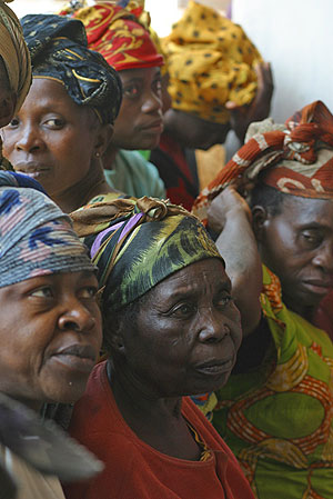
Photo credit: UNICEFAccess to knowledge is vital at any time. This is especially evident in times of emergency where a lack of knowledge can be disastrous, as graphically illustrated during the Asian tsunami of 2004 when meteorological services were aware of an impending disaster, but were unable to find channels of communication to warn affected communities. Also graphic in this instance was the gendered nature of the disaster – in Aceh, up to 80% of those killed by the tsunami were women. Reasons given for this range from the nature of women’s clothing, that women were more likely to be at home at the time of the tsunami and that women were more likely to put the safety of their children before their own safety.

This is not an isolated case. Natural disaster statistics are rarely disaggregated by gender, although anecdotal evidence suggests that women are disproportionately affected. In addition, analysts argue that disasters occur by design and that the impact of natural disasters shows a bias towards the socially excluded. According to Elaine Emerson:

“On balance, those most socially excluded and economically insecure in any society or

community are least able to access or control resources needed during and in the aftermath of a

damaging cyclone or lengthy drought. Women, the frail elderly and children, members of

subordinated cultural or racial groups, the chronically ill, undocumented residents, the pre-disaster

homeless, and other socially marginalized populations are least likely to have the social power,

economic resources, and physical capacities needed to anticipate, survive, and recover from the

effects of massive floods, long-lasting drought, volcanic eruptions, and other extreme environmental events.”


This has led to aid and relief agencies such as Oxfam attempting to counter previous gender-blind policies that worsened the impact of disasters on women. The lack of gender disaggregated informationi on the impact of natural disasters is a key problem in addressing the gendered nature of their impacts.

This article will compare two very different situations, that of a comparatively developed nation in the Middle East and a nation that has been ravaged by over a decade of civil strife and war. Jordan in the Middle East has one of the lowest interneti penetration rates in the region, but almost a fifth of people have internet access. The GDP per capita, in purchasing power parity of Jordan is over 10 times that of DRC.

The Democratic Republic of Congo has an average life expectancy of just 45 and internet penetration of under 2 percent. While urban areas are relatively safe from conflict, over 2 million people have been displaced in the Eastern part of the nation, and violence continues to claim around 1,200 people per day, either directly in conflict, or indirectly through deaths due to a lack of clean drinking water or other easily avoidable health problems.

The similarities between Jordan and the DRC are few. But in both societies the status of women remains low, when compared with other countries in the region, and internationally. The Global Gender Gap Report 2006 ranked Jordan as 105th out of 115 countries in terms of closing its gender gap in economic participation and opportunities, while there are few Jordanian women in leadership positions in either politics or business, the number of Jordanian women enrolled in ICT courses has outstripped men, since the mid-00s. Nevertheless, and despite the Governmenti‘s key role in ICT policyi, women make up less than a fifth of the core ICT workforce.

One of the main problems women have in accessing knowledge is directly related to poverty and illiteracy. In both countries, the interviewees said the problem of access to knowledge in an emergency situation is only part of a general problem of women’s access to knowledge – although women’s literacy rates in Jordan are among the highest in a highly literate region.

This is further worsened when it comes to issues of sexual and reproductive health due to cultural taboos surrounding the discussion of sexual violence – issues that are particularly crucial in DRC where sexual violence is increasingly seen as an acceptable method of subduing one’s perceived cultural or racial enemies. In one month in 2008, 1,200 women were reported to have been raped.

Literacy and education

The main problems facing women who need to access information in an emergency situation are those they are faced with daily. Key among these is low levels of literacy. While in the short-term, such as in a natural disaster, word of mouth or radio are usually key providers of information; in the aftermath a lack of literacy can severely hamper women’s ability to respond to situations or absorb new information quickly and effectively.

This is related to women’s access to education. In DRC, there are few women who attend university, and it is seen as an impediment to making a good marriage – educated men prefer wives with little education, according to Lulu Mitshabu. There are few educated role models for women to emulate, either in government or private enterprise, and if a family has the choice between spending resources to educate a boy child or a girl child, the boy child will receive preference. In conflict areas, children of both sexes are faced with the problem of losing several years education due to displacement, and there are few facilities to help those in such a situation – the already over-stretched aid agencies are concentrating on ensuring the short-term survival of the refugees. Considering both the long-term nature of the conflict and that there are no apparent solutions in sight, this problem is acute. Ms Mitshabu also says that the impact of this on access to knowledge is disastrous – not only are children unable to read or write, this also hampers their ability to assess information, making them vulnerable to manipulation, particularly dangerous in a conflict that is fuelled by racial tensions.

In contrast, women’s access to education in Jordan is comprehensive. There are more girls enrolled in primary school and secondary school. Yet, according to Daoud Kuttab, this disguises regional (and generational) differences in literacy and access to knowledge. And while Jordan has made vocal commitments to ensuring that it is considered a prime destination for ICT investors, particularly those looking at outsourcing operations, there was nothing that specifically addressed gender inequities in ICT access until May 2007. The new policy says “Government notes the importance of the ICT sector with respect to women’s role in Jordanian society and the Jordanian economy. Accordingly, Government will work with stakeholders to ensure the continuous promotion of women’s participation in the IT sector through the support of women’s empowerment.”

This does not mention any specific commitment to not only ensuring women have access to ICT education, but also that there are appropriate job opportunities for them once they leave tertiary education.


Infrastucture

In both Jordan and DRC, a lack of infrastructure was seen as a key impediment to the generalised lack of information dissemination. In DRC, for example, in the earlier days of the conflict, one of the key means of transmitting information was via community radio. Community radio was key in informing people of possible attacks and in providing information on rehabilitation after attacks.

In addition, the ability of people to receive radio signals has been severely eroded. Many refugees have been forced to flee their homes repeatedly. In many instances, a person with a radio may become a hub for a community anxious to learn news.

Lulu Mitshabu says that community radio was particularly important to women, as it was not only more interested in the concerns of women than statei-sponsored media, it gave women a chance to be heard on radio. This was an effective means of empowering women, and helping women leaders in the community to spread information. However, given the scarcity both of transmitters and receivers, this is no longer an effective means of transmitting information.

Even less effective is internet and computer technology – even in the comparatively developed state of Jordan. In both countries, the technology is confined to an urban elite. In DRC, single women may access the internet through cafes, mainly to communicate with relatives overseas – but even this is curtailed by their husbands once they are married. In both countries, access to the internet in remote areas, and in DRC in the conflict areas, is severely limited, both by the infrastructure and by the levels of computer and internet literacy.

It is an area of policy development that has been lacking, not just in Jordan but in the region. While Jordan both hosted the World Association of Community Radio Broadcasters (AMARC)’s Ninth General Assembly and has approved community radio licences within university campuses, AMARC has recommended improving legislation to allow more community radio licences. Daoud Kuttab says it is the best way to help women take control of information, “A community radio station in Jordan is the perfect communication tool that will provide people of all ages and social backgrounds of vital information that they need whether it be related to daily needs or farming needs.”

Credibility of information

In DRC, the ability to disseminate vital information rapidly is also hampered by the skepticism of recipients of information. Having been victims of conflict for over a decade, people will only believe information from trusted sources, often those known to them personally such as village chiefs. Women’s subordinate position in society and their lack of education can limit their effectiveness as providers of information, reinforcing men in their position as gatekeepers of information.

This tendency for men to be gatekeepers is a situation that has been worsened in the conflict years in DRC. This in turn means that information that could save women’s lives, such as simple information on hygiene and health-care, is often not transmitted to the women who need it, as men do not see the transmission of this information to women as being important.

However, when educated women return to their villages, they can play this role – but few choose to do so. According to Lulu Mitshabu, this is partly because of the limited opportunities at the village level and partly due to migration of educated women overseas, where they are more likely to find educated marriage partners and greater opportunities.

Effective Technology

Unfortunately, the experience in DRC seems to indicate that all effective means of accessing knowledge are controlled by men. In Ms Mitshabu’s experience there are two major effective ways of communication, that can help in disaster preparedness and recovery. The first is mobile phone technology. The infrastructure for mobile phones is difficult to target, and has been largely unaffected by the conflict. SMS messages can be used to effectively disseminate information to a large audience in a short period of time. Unfortunately, mobile phones are largely the province of the men. There is no perceived need for women to own a mobile phone, and even if they did, the low literacy rates make SMS services largely useless.

The second way of effectively transmitting information is through traditional leadership roles – chiefs spreading information on how to deal with potential or existing threats. Once again, this largely excludes women from a role in either disseminating or receiving information. However, it is useful in ensuring that information transmitted is perceived as credible. This is also a network that has proved resilient in the face of conflict. It has the major downside of reinforcing existing gender roles.

Ways forward

In Jordan, where the Government is behind an initiative to put a computer in every home, emphasis needs to be given to making sure relevant information is available and to improve women’s computer literacy. However, Daoud Kuttab emphasises that this is not enough. He says, “Women need to take charge of the entire informational cycle that affects them from the source of information to the platforms that are available in which women are in editorial and senior managerial positions as well as ownership in the case of community media.”

He also points out the need to undo the impact of the filtering process of the male-dominated media and policy.

In DRC, Lulu Mitshabu says the need is to focus on low-tech solutions to disseminating knowledge, such as using posters and t-shirts. These need to be highly pictoral to ensure that they are effective regardless of literacy rates. In terms of emergency information, she stresses the need to set up parallel structures to mirror the informal networks that exist among men, helping to cultivate leadership among women and to encourage educated women to return to their communities to take up a leadership role. The main problem in the DRC remains not just that aid is provided in a gender-blind fashion, but also that there is not enough aid to provide for the humanitarian disaster of the region.

Famine War Drought Relief on a dark background with a red African Map

FWD Campaign Logo

Rajiv Shah, Administrator of the United States Agency for International Development (USAID)—in partnership with the Ad Council, launched last week the “FWD campaign”; an initiative that highlights the devastating effects of the crises in the Horn of Africa and encourages people to spread awareness. You can donate $10 by texting “GIVE” to 777444 famine relief.

FWD stands for Famine, War, Drought: the three root causes of the dire situation in the Horn. The campaign is also a call to action—that people get informed, get engaged and forward this information on to their friends, colleagues, and families.

The FWD campaign is a novel USAID initiative that aims to improve communication with the American public and share information. “Frankly, it’s the first foray the agency is taking into open government, open data, and citizen engagement online,” said Haley Van Dyck, Director of Digital Strategy at USAID. The goal is to make data open and sharable to tell stories about the crisis and the work being done on the ground in an interactive way.

Open government, open data

One of FWD’s objectives is to make information, data and maps easily accessible to online audiences. To this end, USAID provides infographics, interactive maps and tool kits that people can use to learn about the crisis in simple, clear ways—and more importantly share that information with others. The agency builds the maps with open source mapping tools and data sets publicly accessible on data.gov. The six interactive maps available provide details on food insecurity, drought, affected populations, refugees and Internally Displaced Persons (IDPs) movements as well as USAID’s response.

Citizen engagement

To raise awareness and engage the public using social media, USAID has partnered with Google, Facebook and Twitter to make information-sharing as easy as searching, tweeting or updating one’s status. There’s also a series of Public Service Announcements (PSA) that will air in major media markets throughout the country. These PSA’s will be made available on the agency’s website, as well as on YouTube.

The fundraising component of the FWD encourages people to donate $10 to famine relief by texting “GIVE” to 777444. The agency is partnering NGOs delivering critical assistance in the Horn. General Mills has agreed to match the first 2,000 text donations that come through the FWD campaign, up to $20,000.

A need for urgent response

Alarming facts about the crisis in the Horn should prompt the public to follow in the footsteps of Andrew Andasi, an 11-year-old

Dark silhouette of a child, the number 6 inside a clock-shaped circle with a text at the topGhanaian schoolboy, who used social media tools to raise $4,000—as of August—for famine victims. The crisis is killing, starving, or displacing over 13 million people. It is the worst drought in 60 years and the worst famine in 20 within a context of continued violence. In Somalia, one child dies every six minutes: the time it will take to finish this piece.

Getting involved is as simple as texting “GIVE” to 777444 to donate $10. More importantly, you can “FWD—forward—the facts” by tweeting, e-mailing, and updating your Facebook status to spread awareness about the crisis. The FWD campaign is an innovative way to engage citizens into action by making data easily accessible to the public.


Copyright © 2020 Integra Government Services International LLC