Tag Archive for: Data

USAID Report

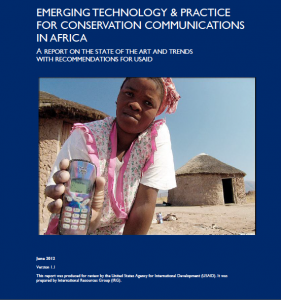
A key recommendation by a USAID report that was released in June and titled “Emerging Technology and Practice for Conservation Communications in Africa” is for international development agencies to institutionalize good practice in the use of ICTs for Conservation. The report noted that while the conservation community has a wealth of experience in harnessing ICTs and communications among its many members, the distribution of this expertise is uneven.

Read more

Does ‘openness’ enhance development?

This was the question explored in a packed Room 3 (and via livestream and Twitter) on the last day of the ICTD2012 Conference in Atlanta, GA.

Panelists included Matthew Smith from the International Development Research Center (IDRC), Soren Gigler from the World Bank, Varun Arora from the Open Curriculum Project and Ineke Buskens from Gender Research in Africa into ICTs for Empowerment (GRACE). The panel was organized by Tony Roberts and Caitlin Bentley, both pursuing PhD’s at ICT4D at Royal Holloway, University of London. I was involved as moderator.

As background for the session, Caitlin set up a wiki where we all contributed thoughts and ideas on the general topic.

“Open development” (sometimes referred to as “Open ICT4D“) is defined as:

“an emerging area of knowledge and practice that has converged around the idea that the opening up of information (e.g. open data), processes (e.g. crowdsourcing) and intellectual property (e.g. open source) has the potential to enhance development.”

Tony started off the session explaining that we’d come together as people interested in exploring the theoretical concepts and the realities of open development and probing some of the tensions therein. The wiki does a good job of outlining the different areas and tension points, and giving some background, additional links and resources.

[If you’re too short on time or attention to read this post, see the Storify version here.]

Matthew opened the panel giving an overview of ‘open development,’ including 3 key areas: open government, open access and open means of production. He noted that ICTs can be enablers of these and that within the concept of ‘openness’ we also can find a tendency towards sharing and collaborating. Matthew’s aspiration for open development is to see more experimentation and institutional incentives towards openness. Openness is not an end unto itself, but an element leading to better development outcomes.

Soren spoke second, noting that development is broken, there is a role for innovation in fixing it, and ‘open’ can contribute to that. Open is about people, not ICTs, he emphasized. It’s about inclusion, results and development outcomes. To help ensure that what is open is also inclusive, civil society can play an ‘infomediary‘ role between open data and citizens. Collaboration is important in open development, including co-creation and partnership with a variety of stakeholders. Soren gave examples of open development efforts including Open Aid Partnership; Open Data Initiative; and Kenya Open Government Portal.

Varun followed, with a focus on open educational resources (OER), asking how ordinary people benefit from “open”. He noted that more OER does not necessarily lead to better educational outcomes. Open resources produced in, say, the US are not necessarily culturally appropriate for use in other places. Open does not mean unbiased. Open can also mean that locally produced educational resources do not flourish. Varun noted that creative commons licenses that restrict to “non-commercial” use can demotivate local entrepreneurship. He also commented that resources like those from Khan Academy assume that end users have a computer in their home and a broadband connection.

Ineke spoke next, noting that ‘open’ doesn’t happen in a vacuum. Sometimes power relations become more apparent when things become open. She gave the example of a project that offered free computer use in a community, yet men dominated the computers, computers were available during hours when women could not take advantage of them, and women were physically pushed away from using the computers. ‘This only has to happen once or twice before all the women in the community get the message,’ she noted. The intent behind ‘open’ is important, and it’s difficult to equalize the playing field in one small area when working within a broader context that is not open and equalized. She spoke of openness as performance, and emphasized the importance of thinking through the questions: openness for whom? openness for what?

[Each of the presenters holds a wealth of knowledge on this topic and I’d encourage you to explore their work in more detail!]
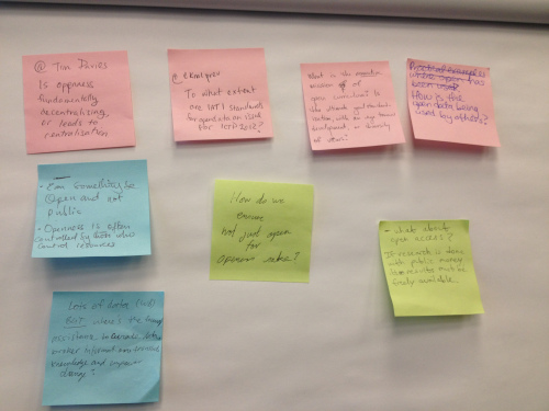
Following the short comments from panelists, the room split into several groups for about 15 minutes to discuss points, tensions, and questions on the concept of open development. (See the bottom of the wiki page for the full list of questions.)

We came back together in plenary to discuss points from the room and those coming in from Twitter, including:

  • Should any research done with public funds be publicly open and available? This was a fundamental values question for some.
  • Can something be open and not public? Some said that no, if it’s open it needs to be public. Others countered that there is some information that should not be public because it can put people at risk or invade privacy. Others discussed that open goods are not necessarily public goods, rather they are “club” goods that are only open to certain members of society, in this case, those of a certain economic and education level. It was noted that public access does not equal universal availability, and we need to go beyond access in this discussion.
  • Is openness fundamentally decentralizing or does it lead to centralization? Some commented that the World Bank, for example, by making itself “open” it can dominate the development debate and silence voices that are not within that domain. Others felt that power inequalities exist whether there is open data or not. Another point of view was that the use of a particular technique can change people without it being the express intent. For example, some academic journals may have been opening up their articles from the beginning. This is probably not because they want to be ‘nice’ but because they want to keep their powerful position, however the net effect can still be positive.
  • How to ensure it’s not data for data’s sake? How do we broker it? How do we translate it into knowledge? How does it lead to change? ‘A farmer in Niger doesn’t care about the country’s GDP,’ commented one participant. It’s important to hold development principles true when looking at ‘openness’. Power relations, gender inequities, local ownership, all these aspects are still something to think about and look at in the context of ‘openness’.

The general consensus was that it is important to fight the good fight, yes, but don’t lose sight of the ultimate goal. Open for whom? Open for what?

As organizers of the session, we were all quite pleased at the turnout and the animated debate and high level of interest in the topic of ‘open development’. A huge thanks to the panelists and the participants. We are hoping to continue the discussions throughout the coming months and to secure a longer session (and a larger room) for the next ICTD conference!

Note: New Tactics is discussing “Strengthening Citizen Participation in Local Governance” this week. There are some great resources there that could help to ground the discussion on ‘open development’.

Visit the ‘does openness enhance development’ wiki for a ton of resources and background on ‘open development’!
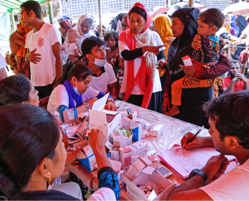
 

Photo Credit: Daniel Katz

Access to timely and accurate data on farmers, their households and farm activities is key for policy, decision-making and quality control for development organizations, national governments, funding agencies, project implementers, field workers, researchers and farmers themselves. Demographic data (past and present) on farm households such as land sizes, assets owned, types of soil, weather conditions, gender distribution, literacy levels, types of commodities being produced, diseases and pest, facilities for storage, among others are critical.

Unfortunately, the current status of data on developing nations’ agriculture at both local and global levels is far from reaching the stage at which policy makers can confidently draw upon for intervention due to the complexities with collection and analysis. The result is inefficient flow of resources into these communities due to under or over investments. The challenge is both socio-technical – human skills to design the necessary protocols for capturing these data as well as technological tools to facilitate the management (capturing, analyzing, sharing, etc.) of the data.

For far too long, exploring the role of ICT solutions to support value chain actors in this area have been ignored even though viable and potent ICT tools are in the market. ICT solutions identified in this component could be used in building and generating electronic forms for data gathering, help in timely access to data, facilitate easy and accurate data analysis, ensure monitoring of field activities, help in tracing of goods from farm gate to consumers, and assist in certifying commodities for quality assurance.

Photo Credit: Uganda App Lab

Potential ICT Solutions to Facilitate Agricultural Policy & Decision-Making

These are ICT solutions that facilitate accurate data capturing, analysis and sharing on farmers, their farm sizes, assets, commodities and other key identifications for enhancing policy decisions making by field staffs, governments, investors, donors and feedback into research and development. Examples of apps identified in this category includes iFormBuilder, a mobile platform for building robust forms, offline data capturing and managing data and users from any browser with the iPhone, iPod touch, or iPad with image and audio recording, GPS and mapping functionality, etc; Mobenzi Researcher that uses simple feature phones to high-end handsets to provide a tried and tested solution to enhance field research and data collection; and PoiMapper, a mobile point of interest data collection and sharing solution for affordable GPS-enabled feature phones that can make agricultural fieldwork more efficient and reliable through planning and monitoring of field activities.

Potential ICT Solutions for Traceability and Quality Assurance

These are ICT solutions to facilitate data gathering on farmers, their fields and specific information on their commodities for traceability and quality assurance. Examples include SourceTrace, a suite of ICT applications including traceability module that records delivery and transaction of data both entered manually into mobile device as well as from GPS, RFID and bar code readers, certification module for internal agricultural monitoring processes of agricultural commodity firms such as Fair Trade, and processing module that automates the capture of valuable information on the various light industrial processes of any agricultural commodity; Reliable Information Tracking System (RITS), a new coffee traceability program that is helping coffee growers become more efficient, reliable, and quality-focused by tracking deliveries of coffee from each member down to the details of what coffee varietals and quality score each lot of coffee receives; and, Integrating ICT for Quality Assurance and Marketing, a project that helps to build an internal control system for inspectors of Organic Producers and Processors Association of Zambia (OPPAZ) for quality assurance and thereby improve the value of the products for increased income.

In summary, ICTs have great potential for data management within the agricultural value chain for increased agricultural growth. Improved data used will influence how research is conducted and subsequently the kind of policy decisions that need to be made for funding and investment. For detailed information on ICT solutions for monitoring, evaluation and quality assurance visit ICT4Ag Database by GBI for an interactive experience and feedback.

Data Basin, an online system, is quickly growing in popularity among practicing educators and community groups that wish to tell compelling stories with graphics. Data Basin connects users with spatial datasets, tools, and expertise through a user-friendly platform where “individuals and organizations can explore and download a vast library of datasets, upload their own data, create and publish analysis, utilize working groups, and produce customized maps that can be easily shared.”

In a presentation on its potential, Jame Strittholt, Data Basin’s founder and Conservation Biology Institute‘s Executive Director called it Google Earth on steroids meets Facebook, allowing groups to communicate with each other by integrating conservation data, mapping, and people. The site contains groups for specific topics and issues and centers for targeted geographies. The core functions of Data Basin are free and a fee-based consulting service is available for those who wish to take full advantage of its features or store significant amounts of data. Currently a great variety of biological, physical, and socioeconomic data is available. Maps can be kept private, within groups, or open to the public.

Data Basin was created out of the need for a central access point for environmental conservation related datasets that people can explore. The tools are easy to understand and use, making it an excellent resource for nonprofessionals or those unfamiliar with ArcGIS. Data Basin was implemented by the Conservation Biology Institute in partnership with ESRI.

Photo Credit: Next2.us

Next2 is a “geosocial” network that allows people to automatically connect around location and by common topics of interest or concern.  By sending a text message, a Next2 subscriber can signal what they have, want or would like to learn or talk about and Next2 automatically matches and then exchanges text messages between users based on similar location and overlap of sharing “circle” without revealing a user’s mobile phone number.

I believe the Ag. Sector is interested in seeing new ICT solutions (apps) that reduce or remove some of the existing bottlenecks in the process of sharing agricultural content between and among rural farmers, extension service providers, and researchers in the developing world.

So what is unique about the Next2 app? One prospect I noticed about the Next2 solution is its professed capability of connecting people with common interest. In the context of rural agriculture, I foresee the improvement in sharing of local knowledge and innovations among farmers – a kind of horizontal/intra communication among the farmers. Next2 app may contribute to the production and sharing of user-generated agricultural content among farmers. It could also increase the density of communication network between farmers and other stakeholders.

Next2 also professes to take simple feature phones without data connection and through use of SMS puts those phones on the Internet. I wonder if this could be an alternative solution to the use of smartphones in share agricultural data between and among farmers, extension service providers and researchers. By going to a Next2 subscribers web page and clicking on a link you can send the subscriber a message, the message appears on the subscribers mobile phone as a new text message, the subscriber can reply by text message, and the Next2 software routes it back to the sender as SMS or email. Of course, access to the minimum Internet service will be required.

The aims of the Next2 solution are:

  • Making the lives of people at the base-of-the-pyramid (BoP) significantly better by enabling them to discover, connect, communicate and thereby mobilize local solutions to local problems,
  • Giving under-served and over-looked populations an Internet presence and messaging identity that creates a bridge between them and Internet users,
  • Empowering local channel marketing partners to introduce Next2 to the communities they serve to quickly and aggressively drive content creation, content distribution and grow significant value to end-users,
  • Building SMS, access phone number(s) across the African continent so subscribers can conduct cross border communication and trade to foster regional markets and economic development in agricultural and other industries,
  • Enabling brands, entrepreneurs, businesses, NGOs, government agencies and researchers to reach Next2 users and/or incorporate Next2′s communication platform, features and/or data in their own applications.


The use of the innovation is being considered in Kenya, Nigeria and Ghana for agricultural partners who can create a Nokia App for farmers. The solutions is similar to how FrontlineSMS works but instead of plugging a SIM card into a personal computer, SIM card is rather plugged  into a in-country hosting provider that then connects the SIM card to the cloud solution of Next2 on Amazon server.  Through that, Next2 is able to use a long-code to provide Next2 solution to all farmers in a given country.

Will be monitoring and looking forward to more analysis on the use of the app from the field as it is piloted.

More information here.


A recent study undertaken in Haiti found that mobile phones can deliver critical information on population movement rapidly and accurately following disasters.

Richard Garfield presented the findings from the research he conducted with several other public health specialists and social scientists at a recent mHealth working group meeting using data from mobile phone networks before and after the 2010 earthquake that rocked Haiti. The publication explains how the research team used position data of SIM cards from Haiti’s largest mobile phone company, Digicel, to estimate population movement trends following the earthquake and the subsequent cholera outbreak.

Girls with phone in Haiti after earthquake- from USAID

Photo credit: USAID

The researchers originally set out to find this data in order to respond to the disaster in Haiti. Knowing that 1 in every 3.8 people in Haiti owned a cell phone, they collaborated with Digicel to track the number of calls and the location of those calls over the course of a year, before and after the earthquake. Most mobile users were based in Port-au-Prince where the earthquake was centered. While cell reception was down for a few days immediately following the quake, the network capacity was rapidly re-established, making the phones easy to trace.

A 22 % decline in phone usage in Port-au-Prince after the quake correlated with the massive outflow of population from the capital, which was widely known. In the aftermath of the disaster, the UN and Haitian government had created maps based on eyewitness observation to track population movements. But because these were reliant on eyewitnesses, there was no way to tell how accurate the data was.

In fact, the mobile phone usage analysis showed different results from these official maps, showing movement that was more spontaneous and seemingly more accurate. Many of those who evacuated Port-au-Prince originally returned back within 7 days, and this was something the official numbers did not catch right away. Months after the earthquake when the UNFPA carried out a survey in Haiti to retrieve more accurate numbers of where people were and when, the mobile phone data was much more closely associated with these results. The mobile phone data also helped to estimate where the cholera outbreaks were happening and to get people out of the danger zones.

Graph from Richard Garfield mobile data in Haiti article

Estimated net changes of the Port-au-Prince population compared to the capital's population on the earthquake day


Garfield emphasized that while these results do not indicate that mobile data should be used as final, official counts on death tolls, it can provide initial estimates while waiting for more accurate counts. The key point is to mine the data rapidly and assist in a quick response.

Will this research lead to improved quick responses for future disasters? It certainly could be combined with current disaster relief efforts following the recent earthquake in Turkey, such as Google’s Person Finder app or social media response.

Morocco has a rather attractive broadband network

Morocco’s growing broadband network and an increase in competition for video has placed the region at the forefront for regional ICT  investments.

“Whether it be VOIP providers, broadband Internet repackaging, or pay-TV installers, the smaller companies will be called to duty and therefore present a viable option for investors looking to capture a share of the projected $1.44-billion data segment by 2015, or other promising indicators,” says Majd Hosn, a telecoms analyst for Pyramid.

The North African country’s telecom sector revenue will see a 4.1% annual growth rate over the next five years. The telecommunications projections position the industry at $5.47-billion in 2015.

Moroccan communications ministry official Ibrahim Saeed told ITNewsAfrica that he is hopeful that these projections will maintain excellent prospects.

“We have worked hard to build a strong IT and telecom sector and hopefully Pyramid’s report will turn out true,” says Saeed.

“The leadership changes and popular uprisings that have spread in North Africa will take their toll on the stability and growth of Morocco,” adds Pyramid.

“However, (the country will) maintain a strong position compared to other Middle Eastern and North African communications markets.”

Jonathan Terry


One of the important considerations in extending connectivity, be it voice or data services, into small and rural communities, is the need to address scale into more remote locations.  This includes the elements of local support, sustainability, as well as replication.  While the technology elements have for the most part be successfully addressed, the business elements are often lacking–with the result being that once the donor funding comes to an end, all-to-often the initiatives come to an end.

In the summer of 2006, the Sri Lanka LMI project was initiated with the issuance of a Request for Proposal by USAID’s Mission in Colombo.  The RFP sought proposals for establishing at a minimum of 20 telecenters in rural communities across Sri Lanka.  The requirement was that these centers be fully installed and operational within one year of the contract award.  The RFP also required that partners be bought into the proposal on a 2:1 match.

Man sitting at a computer, with a child looking over his shoulder at a conputer screen

Photo Credit: USAID

The winning award to granted to SSG-Advisors who put forward a comprehensive approach for establishing an EasySeva franchise that would rollout the required 20 telecenters.  These EasySeva centers were to be individually owned and operated by local in-community entrepreneurs.  This initial rollout would subsequently be expanded beyond the USAID contract requirements.

To meet the partnership requirement, SSG-Advisors partnered with several firms, including Dialog Telekom, Sri Lanka’s largest mobile operator and who provided broadband access to the centers, and Qualcomm, who provided broadband access through their GSM-HSDPA technologies.  Other partners included Microsoft, the National Development Bank (NDB), Lanka Orix Leasing Company (LOLC), and InfoShare.

The EasySeva franchise built several innovative approaches into its business model.  These innovations included:

Scale—the EasySeva franchise was designed to scale well beyond the original 20 centers as reflected in the contract.

Replicable “Center in a Box”—a replicable configuration was adopted such that a new center with a full set of value-added services could be set up rapidly, with services immediately available to customers.

Locally Owned and Operated—each center is locally owned & operated by an entrepreneur vetted to ensure they are capable of managing the venture.

MicroLeasing—the NDB provided capital funding, with LOLC using these funds to buy PCs that were leased to the franchisees.

MicroLoans—LOLC also made MicroLoans available to the entrepreneurs where there was the need for start up capital and to cover initial operating costs.

Multiple Services & Revenue Streams—the EasySeva centers were constructed to derive revenue from access to content developed and placed on each PC, from local calling via community phones, from international calling via VoIP, from Internet access, copying, faxing, etc.  The centers were also positioned such that they could provide local support to microLending and microLoans services into the communities.

Management & Technical Support—the EasySeva franchise operation also provides management training and technical support to the center owners.

The EasySeva franchise ultimately rolled 55 centers, well beyond the initial target. These centers are typically reaching profitability within 3-4 months after opening their doors to the local community.  The model clearly proved successful in achieving scale, sustainability, and replicability.  For Dialog, the telecom carrier providing the connectivity, these EasySeva centers provided community access for services not otherwise extended to those living in these more remote communities.

The EasySeva example reaches beyond Sri Lanka by providing a proof-of-concept for a scalable and replicable business, financial, and technical approach for extending connectivity and value-added services into smaller rural communities world wide.

I recently finished a chapter for a book to be published by the National Defense University about the persistent problem of information asymmetry in disasters, the condition by which information is disaggregated in such a way that it compounds the already horrendous logistics struggle of humanitarian organizations to provide life-saving aid to victims. Food drops are missed by the general population, the wrong supplies get to the wrong hospital, and water sits on a tarmac rather than getting into the hands of people who are desperate for it. Information asymmetry has two dimensions: the inability to get any data from a lack of access to that information or the inability to take aggregated data and make sense of it all. Often in disasters the first dimension is attributed to a lack of connectivity – whether because of geography or lack of infrastructure (cell phone towers tend to collapse in earthquakes, floods etc.). Six years ago, NetHope and a variety of private sector partners tackled the condition of connectivity in disasters with the creation of the Network Relief Kit (NRK) . The NRK, which fits in a backpack, has a BGAN satellite receiver about the size of a medium-sized textbook. It provides a broadband connection to the Internet, runs off a car battery (or small solar panel) and works almost anywhere on the planet. It has a built-in wireless router for WiFi to support up to ten laptops or Internet phones. So it creates a fast, temporary but crucial voice and data communications hub for a small group of fieldworkers when they need it most immediately – in emergencies.
While the NRK does amazing job of connecting, there are some disasters where the lack of connectivity is compounded in places (like Myanmar after Cyclone Nargis or today’s current conflict in Libya) where autocratic regimes have “shut down” the telecommunications infrastructure or restricted access to journalists. It becomes a situation of not just being able to get public information out but a condition of not being able to get any information at all. As we have seen over the last few weeks, when networks or communication is shut down people revert old network connections (mesh or dial-up) in order to harness new platforms– Twitter, Facebook and other social media – to subvert these network shutdowns. It’s outstanding ingenuity – voice to Tweet for example – and innovation that is providing us with a slew of crisis data. So now we have the information but what do we do with the data? This is the second dimension of information symmetry.

This weekend I met with Gisli Olafsson, NetHope’s Emergency Response and Preparedness Director, as we were both speaking at Harvard for separate events (who knew Harvard was the hotbed of technology, connectivity and enterprise). Gisli, whose blog on disaster response is a great read for anyone interested in this space, told me about the efforts of NetHope, OCHA, and countless other organization and volunteers around the world. Spread across the globe, connected by technology and social media this group is monitoring social media, mainstream media and response organization reports for updates on the terrible situation in and around Libya. I remember this group well from my time in Haiti almost a year ago. Following the devastating earthquake in Haiti this volunteer community rose up to try to help in their own way the people affected by that terrible disaster. Thus was born a new opportunity to improve situation information management that leveraged the human capital of countless volunteers around the world to tackle the very sticky problem of information asymmetry.

Screenshot of Libya Crisis MapThe efforts of this group (OCHA, UNOSAT and NetHope have been collaborating with the Volunteer Technical Community (VTC) specifically CrisisMappers, Crisis Commons, Open Street Map, and the Google Crisis Response Team over the past week) are available now for the public here. For the general public this is a fascinating look at the revolution of connectivity, technology, social media in reporting and responding to one of today’s most pressing global crisis’. For the people of the UN and its agencies, NetHope’s 32 international NGOs and countless others who are responding to the crisis this information provides the pivot point for rapid response and an important tool in overcoming the persistent condition of information symmetry. As this movement gains stream and structure the chapter I wrote less than six months ago may become a bookmark of the past as we begin to stage our response and resources in a way that saves countless lives – but hey I’m not going to feel too bad about my outdated chapter because that is the pace of innovation coupled with the persistence of the human spirit.

Copyright © 2020 Integra Government Services International LLC