Tag Archive for: remote sensing

USAID Report

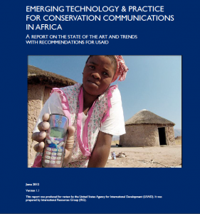
A key recommendation by a USAID report that was released in June and titled “Emerging Technology and Practice for Conservation Communications in Africa” is for international development agencies to institutionalize good practice in the use of ICTs for Conservation. The report noted that while the conservation community has a wealth of experience in harnessing ICTs and communications among its many members, the distribution of this expertise is uneven.

Read more

Green leaves of a Cassava plant

Credit: Farm Africa

After two decades of civil war and amid a tense truce, the world recently welcomed its newest nation, The Republic of South Sudan.  But like many of its Sub-Saharan neighbors did 50 years ago, South Sudan joins the rank of nationhood with a raft of intractable developmental  challenges– and the high expectations of 8 million people adds importance to each.

While the slate of challenges at hand are all important for sustained socio-economic development, achieving national food security will be key to the success of the nation.  It is a vital part of  national security and nationhood. But achieving self-sufficiency in food production and food security will require full transformation of the embryonic nation’s agricultural sector.

Although the sector accounts for the majority of economic activity—33% of the rural population lives on agriculture, whereas 45 % and 12 % are agro-pastoralists and fishermen respectively—the industry is stuck in a pre-industrial form. This is particularly bothersome as new nations must effectively manage their citizens’ expectations–for basic services, jobs and food–to thrive.

However, the country has been unable to provide enough food for the people of South Sudan since the signing of the Comprehensive Peace Agreement (CPA) in 2005. More than a fifth of the population depends on food aid, and the majority of the country’s food is imported from neighbouring countries, many of which are unstable. This doesn’t bode well for the country, and begs the question: where is the national food policy that would foster sustained food production and security? What should a national food policy for South Sudan entail?

A map showing the 10 states of South Sudan in various colours

Credit: South Sudan Forum For Public Policy

As I noted earlier, at the heart of any food policy must be the repositioning of the agricultural sector. South Sudan’s agriculture is characterized by subsistence farmers and disproportionate involvement in agriculture and forestry, compared to livestock and fisheries. There ought to be a concerted campaign to educate farmers about the importance of diversifying their crops and exploring opportunities in the livestock and fisheries sector.

This will require the bridging of the information divide.  In other words, South Sudanese farmers ought to have improved access to better extension services and information that will sensitize and inform them about markets. ICTs will be useful tools for enabling this and should therefore form a central part of the overall food security strategy for South Sudan.  However, the full incorporation of ICTs will depend on improvements in connectivity and access– mobile subscription, broadband access and total internet users are all less than the average for Sub-Saharan Africa.

Nonetheless, traditional ICTs such as radio, which is relatively ubiquitous in South Sudan, may be used as a key first step to offer extension services that tackle issues, including irrigation cycles, pest control, access to seeds,  fertilizer, transportation and prices. These services may be provided via a series of  regularly aired radio programs and features that capture the voices and interests of the farmers.  The use of traditional ICTs and other less advanced but newer technologies are likely to be more contextually relevant and appropriate, compared to high end ICTs. The latest technology is not always suitable. In the long-term, many opportunities to use the latest ICTs will mature. That is to say, they exist now, but the infrastructure in not in place to facilitate their effective implementation for the benefit of the majority.

Here are a few of the ICT opportunities:

  • The provision of access to financial services via mobile money
  • Improve irrigation and water management services using remote sensing technologies and GIS
  • Establishment of legible rural and agricultural markets through market information systems
  • Reduction of waste through proper storage and transportation facilities enabled by logistics technology
  • Text and other mobile-based  extension services to create access to better agriculture and livestock  inputs

Despite the immense scope for growth in South Sudan’s agriculture sector, much depends on the development of indigenous agricultural and livestock research, animal health services, infrastructure (including roads and bridges), and the stability of the  regulatory and political environment.
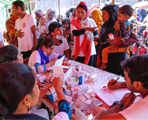
Consistent with the view that the crafting and implementation of bold and strategic ICT policies is key for sustained agricultural development in the developing world, I have pointed out the need for improved policy frameworks in a range of countries. However, it is also important to commend those developing states that continue to make progress in this regard. Tanzania’s national e-government policy is one such example. This policy framework has enabled the Ministry of Water and Irrigation (MoWI) to develop a long-term ICT strategy, which includes using GIS, radio and cell phones, to deliver irrigation and water services.

Picture showing an irrigation system- green plants being watered.

A Guide To Irrigation Methods — Irrigation Systems

The nascent strategy aims to achieve two pivotal things by 2014. First, it intends to help managers and engineers identify areas suitable for and in need of irrigation. The lack of reliable information and poor data collection processes has been a key challenge. To combat this, MoWI’s ICT strategy paves the way for the use of remote sensing and GIS technology to gather information on soil quality and available water resources. According to Daily News Online, Joash Nytambehead, head of the ICT unit at MoWI, says a system has been developed to capture data on all water points in the country. It involves visits to water points where GPS receivers are used to record and later collate coordinates. This is being complemented by efforts to map cellphone and internet connectivity, and access to traditional ICTs such as radio, across the east-African country.

Cellphones are currently being used by field officers to collect and instantaneously relay data on the condition of pumps and the types of crops being grown, which promises to strengthen the planning process. Managers will be better able to make use of GIS and field information to efficiently determine priority sites and the nature of irrigation systems that are needed. This is a major positive development because integrated water management is lacking in Sub-Saharan Africa, the region with the greatest dependence on rainfall, yet home to poor water management procedures and irrigation services.

The second and equally essential aim of Tanzania’s ICT strategy is that it should enable the state to efficiently inform the population about efforts to improve irrigation services. This is crucial because too often great projects flop when intended beneficiaries are left in the dark. The efforts to map mobile and internet connectivity, as well as, access to radio and other traditional ICTs, will allow the state to plot who may be target via the web, text massaging versus radio/TV programs and PSAs. This strategy is also expected to pave the way for streamlining services across offices and departments involved in the project.

While not a panacea, this policy position is a bold step in the right direction. The mix of ICTs that are being used to improve Tanzanian’s access to irrigation services is relevant and culturally appropriate.


Entomologist Richard Mankin examines signals collected by an inexpensive prototype system (on the bench, at his fingertips) for automated insect detection and identification.

Photo Credit: Agricultural Research Service

It may sound a little far fetched for development right now, but using off the shelf components to detect insects by sound could have some important applications in environment, health, and agriculture some day – and these days, “some day” always seems a  little sooner than you would expect.  This could be important for example in identifying the vector of a particularly virulent emerging infectious disease, or in early detection of and rapid response to an invasive forest or agricultural pest.  File it away in the “you never know” drawer.

Researchers collect ‘signals intelligence’ on insect pests.

Or more precisely, swarming micro air vehicles, to create a communications cloud where infrastructure is destroyed during an emergency like an earthquake.  SciDev reports on a Swiss  innovation that hovers at the extreme end of ICT4D – at least for now.  Flying robots could help in disaster rescue – SciDev.Net.

But the same team also produced the awesome SenseFly drone, which costs around 9K and fits in a briefcase.  The possibilities for monitoring and mapping for biodiversity and agriculture appear to be endless. Check out the video.

Lest you think I’m a shill for the Lausanne techies, let me take the opportunity to draw your attention to some homebrew options.  These won’t create the swarming communications cloud suitable for a major disaster, but a lot can happen.

Grassroots Mapping is a network of technology hackers that use balloon and kite mounted digital cameras in mapping, to serve as “community satellites” – a low cost remote sensing alternative to satellite imagery that can get surprisingly good results.  Significantly, the technology is affordable and can be put in the hands of communities for participatory planning, independent monitoring, and access to information – key aspects of our quest for good governance.  The Public Laboratory for Open Technology and Science is a sister initiative working to develop new technologies for grassroots mappers.

I’ve mentioned Participatory GIS – the use of GIS in community mapping – in earlier posts.  PPGIS is a virtual network online consisting of resources and a very active email list to support a peer-to-peer learning network spanning the globe.

So there you have it – we started with a drone swarm and ended up with a kite. The needs of tomorrow (and today) will be well served by one or the other.

As the wise one said, knowledge is knowing that the tomato is a fruit.  Wisdom is knowing not to put it in a fruit salad.

Copyright © 2020 Integra Government Services International LLC