The Ukrainian minister of ecology introduced a proposal to implement a new satellite environmental monitoring system to the country’s president the first week of April. This is a major step for Ukraine in independently setting its environmental protection agenda and integrating ICTs for sustainable development. The satellite, which offers better resolution, will be used to monitor illegal forest cutting, natural resource development, industrial and other hazardous leaks, uncontrolled emissions of garbage dumping, etc.

The Africa Soil Information Service (AfSIS) makes one wonder how people coped before it existed. Africa Soil offers an enormous abundance of peer-to-peer information and services, namely data and maps that are georeferenced. The site fills a much needed gap because knowledge about the condition of African soils because it tends to be fragmented and outdated. AfSIS aims at giving the tools needed to maintain the health of the soil resource base as science and technological developments in remote sensing are providing new opportunities for low cost and efficient applications such as digital soil mapping, infrared spectroscopy, remote sensing, statistics, and integrated soil fertility management. Through such efforts areas of risk can be predicted and monitored.The Globally Integrated Africa Soil Information Service (AfSIS) is a “large-scale, research-based project to  develop a practical, timely, and cost-effective soil health surveillance service to map soil conditions, set a baseline for monitoring changes, and provide options for improved soil and land management in Africa.”

AfSIS’s efforts of dissemination and training allow access to farm communities, public and private extension services, national agricultural research and soil survey organizations, the fertilizer sector, project and local planners, national and regional policymakers,and scientists. It is used in Kenya, Tanzania, Malawi, Mali, Nigeria, Ethiopia, Mozambique, and Ghana in partnership with several academic institutions. Through the success of the project , a global mapping effort has emerged.

Some impressive activities include:

  • producing digital soil maps and environmental covariates
  • developing, implementing and maintaining the cyber-infrastructure to operate this effort
  • developing a spatial database of soil management experiments
  • linking the soil management info to the digital maps
  • developing information dissemination mechanisms including websites, method manuals and guidelines, policy brief and a digital atlas
  • mainstreaming the soil health information system

Photo Credit: redd-net.org

The conservation blogosphere is covered in REDD+, but what is it? REDD+ is simply an acronym for Reduce Emissions from Deforestation and Forest Degradation. It aims to foster conservation, sustainable management of forests, and enhance forest carbon stocks through local incentives by creating a financial value for carbon stored in trees. Once this carbon is assessed and quantified, developed countries pay developing countries carbon offsets for their standing forests. By doing so, green house gas emissions can be lowered in a cost-effective way. REDD+ is different from traditional methods because “unlike afforestation and reforestation activities, which generally cause small annual changes in carbon stocks over long periods of time, stemming deforestation causes large changes in carbon stocks over a short period of time.” It also has the benefits of addressing water resource management, soil erosion, flooding reduction, biodiversity, and other issues.

Where is it used? USAID provides a database of current projects. REDD is also being proposed after a recent publication in Nature Climate Change released a study that tropical rainforests store 229 billion tons of carbon in their vegetation. This study, through The Woods Hole Research Center, used new satellite-based assessment, including cloud-penetrating LiDAR (less degree of error).  The findings are available in a free downloadable carbon density map here.


Biomass Map, Photo Credit: WHRC


Photo Credit: CARPE

The Congo Basin is a critical tropical forest that supplies vital regional and worldwide ecological services. It is one of the largest tropical rainforests in the world, home to thousands of endemic plant and animal species such as lowland gorillas, chimpanzees, bonobos, and forest elephants. More than eighty million people depend on its abundance of timber and other natural resources for their livelihoods. A paradoxical note is that despite the richness of the Congo Basin, the people near it are some of the poorest in Africa. The forest is constantly cleared to make room for agricultural pursuits and to feed urbanized areas’ hunger for lumber. In addition to deforestation and forest degradation, illegal hunting and commercial bushmeat trade are major threats to biodiversity.

The Central African Regional Program for the Environment (CARPE) is a USAID longterm and regional initiative formed in 1995 in association with a consortium of government and NGO partners that concentrates its resources on six principal forested countries in Central Africa: Cameroon, Central African Republic, Democratic Republic of Congo, Equatorial Guinea,  Gabon, and the Republic of Congo. Uganda, Rwanda, Chad, Burundi, Rwanda and Sao Tome Principe are also involved in the initiative. CARPE is intended to be a 20-year process, resulting in complete local guidance. A major objective of CARPE is to protect forest resources by reducing degradation and protecting biodiversity. Modern tools such as Landsat satellite-derived maps, remote sensing, GIS, and geospatial databases are used for planning and monitoring of the forest. With this information, threatened species are under the protection of local communities and logging is controlled.


Prior to the development of CARPE, vast areas of the Congo Basin were unknown. Since then, a number of initiatives and activities have taken place, resulting in an overall evaluation in 2011. In this evaluation, CARPE was deemed extremely successful for introducing large-scale ecosystem management approaches. Tens of thousands of individuals have been trained in a variety of conservation methods and techniques. With   empowerment through such training and motivation that educates and organizes local groups to play an active role in forest and biodiversity conservation programs, civil society is being strengthened. This is seen as critical, circumventing the often inefficiently administered and economically weak centralized governments. The tools practiced allow for an understaffed patrol to communicate with a wider audience, limiting the “weak state management of these resources (that) creates a vacuum where local populations are often stripped of benefits as stronger or elite groups including private companies expropriate natural resources at sub-national and local levels.”Where will CARPE head in the coming years? The implementation of land use management plans for micro- and macro- zones, strengthening of government capacity and transparency are key.


Last week The Guardian announced that we’re now able to see the Amazonian rainforest as never seen before. A group of scientists, using LIDAR (Light Detection and Ranging) took images from a plane called the Carnegie Airborne Observatory. The images were taken by bouncing a laser beam off of the forest canopy at 400,000 times per second. The resulting images are vibrant, showcasing variation in biodiversity at unprecedented detail. The new technology will be used to manage the ecosystem, monitoring for signs of deforestation and degradation.

Photo Credit: RBCT

One of the leading programs with interest in the way HIV/AIDS is affecting the environment and natural resource management (NRM) activities is the USAID’s Africa Biodiversity Collaborative Group (ABCG).

ABCG, as a result, has initiated a number of communication strategies to combat the negative impact of HIV/AIDS on the environment. On this 2011 World’s AIDS Day, I find it appropriate to reflect on the role of information and communication technologies (ICTs) in increasing the effectiveness of communication strategies for combating negative impacts of HIV/AIDS on the environment.

Impacts of HIV/AIDS on the Environment and Natural Resource Management Activities

According to ABCG, HIV/AIDS has impacted the conservation workforce, conservation activities, and finances of conservation government agencies, non-governmental organizations (NGOs) and communities. The pandemic has caused accelerated rates of illnesses and deaths among park wardens, rangers, community game guards, senior officials and other conservation personnel; accelerated rates of payment of terminal benefits by conservation government agencies; created competition for scarce financial resources between HIV/AIDS demands and conservation activities; led to accelerated and unsustainable rates of harvesting of medicinal plants and wildlife; is destroying communal social structures on which community-based natural resource management (CBNRM) is based; and has led to land use changes in some places.

The program has identified the following key impacts of the HIV/AIDS pandemic on natural resource management:

  • Changes in land use as agricultural practices change with falling capacity for heavy labor,
  • Changes in access to resources and land especially when widows and AIDS orphans cannot inherit land,
  • Loss of traditional knowledge of sustainable land and resource management practices,
  • Increased vulnerability of community-based natural resource management programs as communities lose leadership and capacity, and HIV/AIDS issues take priority, and
  • Diversion of conservation funds for HIV/AIDS related costs.

ABCG’s Communication Strategies and the Role of ICTs

With the above recognized negative impacts of HIV/AIDS on the environment and natural resource management, ABCG has agreed that ICTs are uniquely positioned to help increase the impacts of their communication strategies. Some of the current approaches being used include:

  • The use of its website with updated materials including PowerPoint presentations, papers, and web links on case studies conducted on HIV/AIDS and environmental conservation.
  • Networking among the regional partners to share useful information on the issue.
  • Workshops
  • International Conferences
  • AIDS and Conservation Posters by ABCG

So how can ICTs be integrated into these strategies for effective impact on HIV/AIDS?

Looking at the great potentials of ICTs for knowledge and information sharing, the current communication approaches by ABCG may have limited use of ICTs for sharing knowledge on best practices about HIV/AIDS and the environment. A host of the emerging social media tools and platforms are excellent avenues for partners to share information on HIV/AIDS and environmental conservation activities thereby facilitating the work of ABCG in its fight for environmental conservation.

a) Blogs taking the form of a diary, journal, and links to other websites could be great tools for sharing and creating awareness of HIV/AIDS on the environment.

b) Twitter accounts can be used to share instant updates from friends, industry experts, favorite celebrities, and others of the impact of HIV/AIDS on the environment, the prevention strategies, and what’s happening around the world with specific focus on natural resource management and HIV/AIDS.

c) Social networking applications like Facebook with pages specifically created on the issue could help bring like-minded individuals and organizations together to discuss the issue online.

d) Events such as Meetup.com and free Wibinar applications such as WebEx channels may be used to connect partners and advocates together to share information and knowledge on HIV/AIDS and the environment.

e) Wikis pages are great knowledge management and collaborative tools that could be used to capture, find, share, and use information on HIV/AIDS and environmental conservation. Wikis help keep knowledge current, dynamic, and safe for members.

f) Photo sharing applications like Flicker, Picasa, Fotki, Mobile Me, Windows Live SkyDrive could be used to share real-time updates on HIV/AIDS and environment through images.

g) Video sharing tools like YouTube could be used to create awareness of the danger of HIV/AIDS on the environment.

h) Professional networking tools like LinkedIn may bring together experts from the various fields – HIV/AIDS, NRM, Climate Change, among others to discuss the issue.

When the necessary ICT policies and infrastructure are put in place among the ABCG collaborating partners and the regional networks, the use of these applications should not be an obstacle to information sharing on HIV/AIDS and the environment.
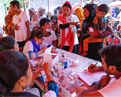
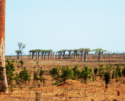
Photo Credit: NanoGanesh

Nano Ganesh is an innovation that is helping smallholder farmers across two Indian states to remotely turn their irrigation pumps ‘on’ and ‘off’ using their mobile phones. In an industry dominated by ringtones and games, this is a welcome move towards technology that serves development, said Vineeta Dixit, a principal consultant at the e-Governance Division of the Department of Information Technology, Ministry of Communications and IT, India.

Nano Ganesh is a GSM Mobile based remote control system exclusively for the use with water pump sets in agricultural areas. A farmer can control the pumps from any distance; check an availability of power supply at the pump end; acknowledge the on/off status of the water pump; and in some models, get alerts through calls if there is a theft attempt of the cable or pump.

The need for Nano Ganesh arose from the routine problems faced by farmers in operating irrigation pumps. In India and other parts of the developing world, a farmer may have to travel miles to turn on a water pump, and stay on the farm until irrigation is complete before returning – at any hour of the day, often late at night or early in the morning. There are, fluctuations in power supply, difficult terrains, fear of wild and dangerous animals on the way to pumps, hazardous locations of the pumps along the river or water storage beds, shock hazards, rains etc.

The clip below summarizes information on the application:


The technology requires a mobile connection and phone, along with a mobile modem that attaches to the starter on the irrigation pump. Using the phone, an assigned code number switches the pump’s starter off and on, and a particular tone signals the off/on status of the pump and the electrical supply at the pump location.

The application which was developed by Ossian Agro Automation, has been selected for recognition as a laureate in the Economic Development category for 2011, by The Tech Awards, The Tech Museum at San Jose, CA, USA. Currently, there are over 10 000 installations across the operational states in India.

Map of Africa

Photo Credit: Zunia

The President of the International Fund for Agricultural Development (IFAD), Mr. Kanayo F. Nwanze, hosted a virtual press conference from his Rome office yesterday, September 29 to discuss why he believes Africa can ensure its own food security through investment in agriculture, with particular focus on West Africa.

The interactive press briefing touched on a number of pressing and interesting issues relating to African agriculture. According to Mr. Nwanze, reducing rural poverty in Africa is a high priority for IFAD, and Sub-Saharan Africa (SSA) remains IFAD’s highest priority, absorbing as much as 40% of new commitments. IFAD investment in Africa and SSA is more than 50% of IFAD’s total investment worldwide. With years of investment and working relations with African experts and governments, IFAD has accumulated a rich experience of what works and doesn’t work in Africa.

The agency has identified with the great challenges facing African agriculture including volatile food prices, changing climate, the challenge of feeding its populace, land grabbing, among others. But at the same time, sees great promise for Africa in the face of all these challenges. Africa has the highest share of the world’s arable land for agriculture, with West Africa alone holding about 284 million hectares of arable land available for investment. Out of this, only 60 million are currently in use. In addition, the region has more than 10 million hectares of land that could be irrigated, but it barely uses 10% of this to its full value. About 60% of Sub-Sahara African is under 25 years of age with high skills and training to be tapped for agricultural growth.

I asked Mr Nwanze what IFAD’s view is on policies that ensure investment in ICTs for agricultural development in Africa. He referenced the on-going Agricultural Knowledge Share Fair (AgShareFair) in Rome with support from IFAD and other UN agencies that brought together people from all over the world including Africa with innovative information and communication technologies for knowledge sharing. IFAD is also supporting many projects in the area of mobile telephony, mobile banking, last mile etc. that are helping in the advancement of agriculture in Africa. Also the use of this virtual press briefing by the President, which made possible for people to participate remotely attests to IFAD’s recognition and commitment to ICTs for development. On policies guiding the creation and administration of Universal Service and Access Funds (USAF) in African countries, Mr. Nwanze recalled a recent meeting by ITU that brought together telecom regulators together to deliberate on its application for development.

Responding to another question from the press as to why Africa is starving, the President stated that Africa is not starving. He cited booming economies in Africa such as Ghana, Rwanda, Tanzania, and Ethiopia where African governments are pursuing sound economic policies thereby enabling the growth of their economies. He cited Ghana as an example that made enormous stride and has great promise for growth with the possibility of transitioning into middle-income country in the near future. He was quick to state, however, that he is ‘no prophet of the future’ to tell how things will turn in these countries. Referring to the crises at the Horn of Africa, the President said agriculture must be made a priority in Africa by all who are interested in reducing poverty and ensuring food security. He called on African leaders to “act now: investing in agriculture is the best way to prevent famines.” African leaders must take the lead and invest in agriculture – no people or nation can make progress with sole external support, the President stated.

On the possibility of investing in green energy for Africa’s agriculture, Mr. Nwanze said it depends on how one defines green energy. According to him, African farmers are already practicing green energy in their farm practices through good soil management practices to prevent erosion and the like.

My main take of the press briefing applies to the question of Mr Nwanze’s view on ICTs investments by African people for agricultural development in Africa. Mr. Nwanze pointed some interesting initiatives by IFAD to expand access to ICTs in rural Africa but it is not clear how much of this is being spearheaded by Africans themselves. On the issue of availability of vast arable lands, huge youth population, and skills in Africa for investment, it is difficult to see how that translate into food security and prevention of future famine in Africa. In this era where Africa is experiencing more and more rural-urban migrations, not only the youth but also the older generations, as a result of declining opportunities and lack of incentives for farming, policies should go beyond mere recognition of ‘rich resources’ on the continent. The President did not mince his words by calling on African leaders to act now, but I also think that there is so much to explore outside African governments and political leaders. The call for investing in low-cost and simple technologies such as information and communication technologies for example should be a fertile ground for Africa’s young entrepreneurs. By creating a conducive environment for investment, Africa could see a wave of young investors especially in the ICTs sector.

Mr. Nwanze also responded to questions from the press covering areas of good governance for agricultural development, south-south collaborations for knowledge transfer to Africa, investment in post-conflict countries such as Liberia, the use of subsidies, and examples of successful models of agricultural development in Africa. The session was covered by over 25 different media outlets across the world in the area of radio, TV, magazine, blogs, multimedia press such as Voice of America, Voice of Nigeria, Deutsche Welle (DW), the Organic Farmer, Think Africa Press, and the Global Broadband for Innovation Program of USAID.

With a greater sense of collective security and a fast-growing economy fueled by its budding oil industry, most of The Republic of South Sudan is poised for recovery and development at the onset of nationhood.

Although South Sudan’s slate of challenges are not easily enumerable, issues relating to the environment, including land degradation, deforestation and the impact of climate change, must be addressed with urgency. This constellation of challenges threaten the newly independent nation’s long-term peace and stability, food security and sustainable development.

But an effective response requires copious, accurate and reliable data that isn’t readily available. This paucity of information about South Sudan’s environmental landscape is due to unique factors brought about by the more than two decades long civil war with its now northern neighbor. The war, which ended with the signing of the Comprehensive Peace Agreement (CPA) in 2005, displaced nearly a half of the population of 8 million and claimed nearly 2 million lives.

Throughout the years of displacement, previously overgrazed lands and wildlife were naturally replenished to some degree. But as an estimated 4 million people return to their ancestral lands on the cusp of independence in a resource rich but ecologically unsound and economically stagnant society, the natural gains made in restoring the environment is in jeopardy. It would be illogical to suggest that the return of a displaced people is within and of itself the cause of this crisis, rather, it is the lack of information about where people will settle and the state of the environment in those places that is at the core of the problem.

To respond to this challenge, the Government of South Sudan (GoSS) ought to make more coordinated use of the 2005 post-conflict environmental assessment it commissioned UNEP

A scatter herd on grass

Photo Credit: Frank Langfitt/NPR

to conduct. The finding from the UNEP study may be transformed into a resource akin to Virtual Kenya, an online interactive web  platform for charting human environmental health with related material for those with no access to the internet. This is one tangible way in which ICTs, including GIS technologies may be used to tackle South Sudan’s environmental challenges.

As I’ve noted in previous blogs focused on South Sudan and the role of ICTs, there is limited scope for the use of high tech ICTs at this point, due to systemic and structural impediments, including literacy, connectivity, access and market environment. However, traditional technologies such as radio ought to be used to provide timely, accurate and contextually appropriate information about environmental conservation. It is important that the farming community, the largest economically active block in the country, be sensitized about this. Land degradation, for instance, is heightened by population pressure, intensification of agriculture, water-logging and salinity, among other things. Both water-logging and salinity are caused by poor irrigation and drainage, deforestation, overgrazing, soil erosion and poverty.

So, as South Sudan claims nationhood, it is imperative that the environment be a priority for the GoSS and its people. A clear ICT strategy with medium to long-term goals is needed. It ought to emphasize how ICTs will be leveraged to improve basic farm extension services to reduce poor soil management, and other agricultural related causes of land degradation. The wider thrust to sensitize the nation about environmental issues ought to also prioritize the well-being of wildlife, much of which was devastated during the war. There is clear economic, environmental and social benefits to be reaped from this.

As with so many nations on the cusp of self-determination, South Sudan can take a path that will secure the fortunes of its people. The preservation of the environment is central to achieving this, and that is only possible if there is national buy-in. Too few governments have been proactive in informing their citizens.

A drawing of a desert with a green tree in the middle

Photo Credit: The Express Tribune

The annual observation of World Day to Combat Desertification is underway amid daunting projections, if immediate mitigation measures are ignored.

Desertification, which is caused by ‘land degradation in dry lands’ (not necessarily the creation of deserts), affects one in three people in some way, and costs the world economy US$42 billion annually. The International Union for Conservation of Nature (IUCN) estimates that almost two billion hectares of land in over 110 countries have been seriously degraded.

Land degradation is heightened by population pressure, intensification of agriculture, water-logging and salinity, among other things. Both water-logging and salinity are caused by poor irrigation and drainage, deforestation, overgrazing, soil erosion and poverty.

But the matter of poverty is two fold, as land degradation pose serious implications for efforts to reduce it and hunger worldwide. The developing world, namely Africa, Asia and Latin America, is home to 90% of those most affected— mostly subsistence farmers. This trend will expand the scarcity of arable lands and water resources, which will increase food insecurity for the most vulnerable. This will also raise political tensions over unequal land distribution across the developing world. A few large landholders own disproportionate hectares of land in predominantly arid countries such as Pakistan.

The UNCCD logo for World Day to Combat Dessertification.

UNCCD logo for World Day to Combat Dessertification

Despite these impending challenges, too few governments have been proactive in informing their citizens. ICTs may be leveraged to improve basic farm extension services to reduce poor soil management, and other agricultural related causes of land degradation. Also, more states should embark on water resources development, water harvesting, well rehabilitation, wildlife restoration and biodiversity maintenance projects to mitigate land desertification and better prepare farmers and others to sustain their livelihoods. The success of any such effort will rest on the degree to which citizens are engaged –the range of ICTs available should certainly be leveraged.

Visit the UNCCD website to learn more about about the day of events.

Copyright © 2020 Integra Government Services International LLC