In the intricate dance of geopolitics, water security stands out as a common concern and a potential catalyst for collaboration. Central and South Asia, regions endowed with abundant rivers and basins, face the dual challenges of water scarcity and the impacts of climate change. USAID is working with Central Asia Governments and research institutions—under the Asia Emerging Opportunities (AEO) mechanism—to evaluate the status and possible causes of lower-than-usual regional water supplies. Over the past year, Integra has delivered snowmelt and glacier melt training modules in Central Asia using data from eight primary river basins to continue this work.

The Wilson Center, a renowned institution for advancing policy dialogue, partnered with Integra to host an event titled “Water at Wilson: MODSNOW – A New Tool for Water Security in Central and South Asia.” The gathering convened experts and stakeholders to explore innovative solutions to the region’s pressing water challenges.

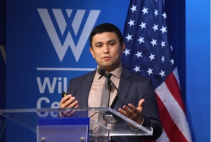
Kicking off with a warm welcome from Lauren Risi, Program Director of the Environmental Change and Security Program at the Wilson Center, the event proceeded with opening remarks from esteemed representatives, including Änjali Kaur, Deputy Assistant Administrator, Asia Bureau, USAID and Ambassador Sridhar Khatri of Nepal. Deputy Administrator Kaur stated, “We’re proud to have partnered with Integra to develop the simple yet remarkably effective MODSNOW, designed to empower governments and Asian communities to monitor water flows from high mountains. This is critical not only for the immediate needs of the present but also for the long-term sustainability and prosperity of future generations.”  Echoing this sentiment, Ambassador Khatri shared that in coordination with Nepal’s ongoing efforts, “the MODSNOW tool developed by Dr. Abror Gafurov, will provide real-time information of water resources and help us to better prepare for disaster response.” Ambassador Baktybek Amanbaev of the Kyrgyz Republic and Ambassador Farrukh Hamralizoda of Tajikistan also spoke about how water security and tools such as MODSNOW are important to their respective countries. These introductory sessions underscored the significance of collaborative efforts in addressing water security issues, setting the stage for a deeper dive into research insights.

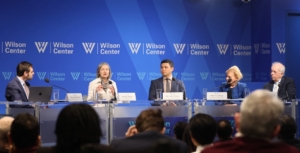
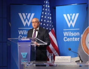
Dr. Abror Gafurov, the Innovative Water & Environmental Solutions (IWES) lead researcher, delivered an informative presentation on MODSNOW, a groundbreaking tool designed to revolutionize water resource management by predicting snowmelt patterns in the Hindu Kush Himalayan region. The subsequent facilitated discussion, expertly moderated by Michael Kugelman, Director of South Asia at the Wilson Center, provided a platform for diverse perspectives and robust dialogue among panelists, including Dr. Eric Rudenshiold, Sherri Goodman, and Mary Melnyk. Audience engagement peaked during the dynamic question-and-answer session, where in-person and online attendees posed thought-provoking queries to the panelists. As the event drew to a close, it left a resonant message of hope and possibility, emphasizing the transformative potential of collaboration and innovation in safeguarding water resources for the future of Central and South Asia.

At its core, MODSNOW represents a fusion of innovation and necessity. The tool leverages advanced modeling techniques to predict snowmelt patterns in a region, often called the “Water Tower of Asia,” as it is the source of major river systems that sustain millions of people downstream. The significance of MODSNOW lies in its ability to provide timely and accurate information about snowmelt dynamics. By integrating satellite data, climate models, and ground observations, the tool offers policymakers and stakeholders crucial insights into water availability and potential risks. This information is invaluable for devising adaptive strategies to mitigate water-related challenges, such as floods, droughts, and the management of transboundary rivers.

During the event, experts highlighted MODSNOW’s multifaceted benefits. By enhancing the understanding of snowmelt processes, the tool empowers governments to make informed decisions regarding water allocation, infrastructure development, and climate adaptation measures. Furthermore, MODSNOW fosters regional cooperation by facilitating data sharing and collaborative research initiatives, transcending political boundaries to pursue shared water security goals.

The Ukrainian minister of ecology introduced a proposal to implement a new satellite environmental monitoring system to the country’s president the first week of April. This is a major step for Ukraine in independently setting its environmental protection agenda and integrating ICTs for sustainable development. The satellite, which offers better resolution, will be used to monitor illegal forest cutting, natural resource development, industrial and other hazardous leaks, uncontrolled emissions of garbage dumping, etc.

Integration of environmental data is critical for water. WISDOM, a Vietnamese-German project, is an inspirational model of how watershed management leads to sustainable use and preservation of water resources. WISDOM combines information from hydrology, sociology, information technology, and earth observation for its implementation of an Information System for the Mekong Delta.

The Mekong Delta struggles against population increase, changing climatic conditions, and regulatory measures. Because of these challenges, extreme flood events occur more frequently, drinking water availability is increasingly limited, soils show signs of salinization or acidification and species and complete habitats are diminishing.

WISDOM’s integrated information system contains available and newly generated data from multiple disciplines, open to users through an accessible query. The IS allows a feed of input from remote sensing, GIS, digital maps, in-situ, interpolated point measurements, and other sources. Available data includes flood and drought risk, water quality, sediment load, discharge, and land use changes.

Lessons learned from this initiative include that the cooperation of national institutes and regional or local authorities needs to be strengthened. Successes include the knowledge transfer provided between German institutions and Vietnamese doctorate candidates and the user-friendliness of the IS that can answer specific and complex questions that support regional planning activities.


Save the Elephants is celebrated for its conservation work in Kenya, Congo, Mali, and South Africa. The four pillars of Save the Elephants are research, protection, grassroots, and education. Each of these pillars is taken seriously in a comprehensive way, keeping in mind that the ultimate approach to conservation is through local knowledge and understanding the elephant’s perspective.

Save the Elephants has used tracking technology since the mid-1990s. The Elephant Tracking Project displays movement patterns and corridors by using ESRI software that verifies GPS data. The tracking device also allows for a Quick Response Unit that notes any disturbances that might signal poaching. An integral part of Save the Elephants’ tracking and research is based off of data collected by GPS/GSM collars that send text messages every couple of hours that contain details on their location, air temperature, and humidity. Currently there are over eighty collars in rotation.

Tracking patterns can be viewed in Google Earth on a moving 3D  backdrop of satellite photos provided by Digital Globe. On top of these tracking images of migratory patterns, stories and events are attached for interaction and educational purposes. Through such tracking, researchers are better able to understand why elephants do what they do and the complex social structures in which they live. Researchers can infer on how the relationship between human settlements and water resources affect elephant movements. By tracking these patterns, protected corridors have been established.


Photo Credit: Save the Elephants


An interesting project that Save the Elephants has taken on is geofencing. Traditional fences can be very costly and often ineffective in deterring bull elephants from raiding small-scale agriculture near human settlements. Geofences send an SMS message to an animal management team when a collared elephant passes through it. The team then can chase the elephant out of the fields and train it through negative reinforcements not to pass through the fence again. The program is being refined to teach elephants where they can’t go and to inform farmers of potential night-raids.

Another project is called SEARS (Spatial Economics and Remote Sensing of Elephant Resources). The organization created a vegetation map of Samburu to monitor migration patterns and the distribution of individual species of vegetation. Through layering the data, researchers can note the size and nutritional value of the vegetation. The goal of this project is to better understand why elephants migrate according to specific corridors and between specific regions. Save the Elephants notes how drastically migratory routes change when there are abrupt transformations in weather norms.

Save the Elephants rejoices in the explosion of communications and technology that allow the outside world to experience remote areas. The organization regularly engages with schools and provides media on their webpage.

Green Prakriya, a joint initiative of Digital Empowerment Foundation and Association for Progressive Communication, was formed to address India’s “tremendous economic growth owing to the influx of the information and communication technology revolution.” With this advancement, a wave of e-waste ensues. The initiative works as an eco-web platform that acts as a green ICT knowledge base for practitioners, policy advocates, policy makers, researchers, professionals and the masses interested in environmental sustainability, networking, coordination, and implementation.


Green Prakriya’s philosophy is:

  • to engage stakeholders working on green technology
  • to develop a network of stakeholders working on Green technology
  • to create a rich knowledge base of technology solutions for addressing environment issues
  • to conduct awareness and outreach programs through seminars and workshops
  • to develop a collaboration amongst scholars and practitioners nationally and internationally
  • to act as a policy advocate
  • to act as an intermediary or medium to promote e-waste management in the city

Green Prakriya strives to bridge the gap of a lack of information and communication of stakeholders aware of the issues of technology waste. The initiative has taken part in mapping exercises and workshops to raise awareness.


Data Basin, an online system, is quickly growing in popularity among practicing educators and community groups that wish to tell compelling stories with graphics. Data Basin connects users with spatial datasets, tools, and expertise through a user-friendly platform where “individuals and organizations can explore and download a vast library of datasets, upload their own data, create and publish analysis, utilize working groups, and produce customized maps that can be easily shared.”

In a presentation on its potential, Jame Strittholt, Data Basin’s founder and Conservation Biology Institute‘s Executive Director called it Google Earth on steroids meets Facebook, allowing groups to communicate with each other by integrating conservation data, mapping, and people. The site contains groups for specific topics and issues and centers for targeted geographies. The core functions of Data Basin are free and a fee-based consulting service is available for those who wish to take full advantage of its features or store significant amounts of data. Currently a great variety of biological, physical, and socioeconomic data is available. Maps can be kept private, within groups, or open to the public.

Data Basin was created out of the need for a central access point for environmental conservation related datasets that people can explore. The tools are easy to understand and use, making it an excellent resource for nonprofessionals or those unfamiliar with ArcGIS. Data Basin was implemented by the Conservation Biology Institute in partnership with ESRI.

Lion/Tiger/Bear Mashup

Photo Credit: Factoidz

Last summer an article caught my eye about the spread of Lionfish in Antigua’s waters, an invasive and predatory creature. The news made me curious if there were other invasive species worthy of  catchphrases and surely enough I wasn’t disappointed to find a diverse selection of tigers and bears.

Invasive species, as the name suggests, originate outside of the ecosystem in which they are found. Thousands of years of climate shifts and our urge to conquer new lands have led to major disruptions that threaten native environments, making them susceptible to damaged local biodiversity, food production, and even human health.

In 2005, ICT Update published an issue on invasive species, marking GIS and other tech responses to the monitoring and elimination of threatening pests. Since this publication there have been successful ICT approaches and projects for invasive alien prevention. What’s my favorite one, you may ask? Well, it’s actually a free, simple to use mobile application called What’s Invasive! With this downloadable application one can geo-tag invasive plants and animals that are specific to the desired geographic location. With this information concerned citizens and other groups can monitor growth patterns and participate in eradication campaigns. Currently, the application is vigorously used in American, Canadian, and European parks. With its easily accessible databases, nature education and other public outreach programs in coordination with  this mobile app can greatly empower local communities to address issues of environmental protection and climate change.


Photo Credit: RBCT

One of the leading programs with interest in the way HIV/AIDS is affecting the environment and natural resource management (NRM) activities is the USAID’s Africa Biodiversity Collaborative Group (ABCG).

ABCG, as a result, has initiated a number of communication strategies to combat the negative impact of HIV/AIDS on the environment. On this 2011 World’s AIDS Day, I find it appropriate to reflect on the role of information and communication technologies (ICTs) in increasing the effectiveness of communication strategies for combating negative impacts of HIV/AIDS on the environment.

Impacts of HIV/AIDS on the Environment and Natural Resource Management Activities

According to ABCG, HIV/AIDS has impacted the conservation workforce, conservation activities, and finances of conservation government agencies, non-governmental organizations (NGOs) and communities. The pandemic has caused accelerated rates of illnesses and deaths among park wardens, rangers, community game guards, senior officials and other conservation personnel; accelerated rates of payment of terminal benefits by conservation government agencies; created competition for scarce financial resources between HIV/AIDS demands and conservation activities; led to accelerated and unsustainable rates of harvesting of medicinal plants and wildlife; is destroying communal social structures on which community-based natural resource management (CBNRM) is based; and has led to land use changes in some places.

The program has identified the following key impacts of the HIV/AIDS pandemic on natural resource management:

  • Changes in land use as agricultural practices change with falling capacity for heavy labor,
  • Changes in access to resources and land especially when widows and AIDS orphans cannot inherit land,
  • Loss of traditional knowledge of sustainable land and resource management practices,
  • Increased vulnerability of community-based natural resource management programs as communities lose leadership and capacity, and HIV/AIDS issues take priority, and
  • Diversion of conservation funds for HIV/AIDS related costs.

ABCG’s Communication Strategies and the Role of ICTs

With the above recognized negative impacts of HIV/AIDS on the environment and natural resource management, ABCG has agreed that ICTs are uniquely positioned to help increase the impacts of their communication strategies. Some of the current approaches being used include:

  • The use of its website with updated materials including PowerPoint presentations, papers, and web links on case studies conducted on HIV/AIDS and environmental conservation.
  • Networking among the regional partners to share useful information on the issue.
  • Workshops
  • International Conferences
  • AIDS and Conservation Posters by ABCG

So how can ICTs be integrated into these strategies for effective impact on HIV/AIDS?

Looking at the great potentials of ICTs for knowledge and information sharing, the current communication approaches by ABCG may have limited use of ICTs for sharing knowledge on best practices about HIV/AIDS and the environment. A host of the emerging social media tools and platforms are excellent avenues for partners to share information on HIV/AIDS and environmental conservation activities thereby facilitating the work of ABCG in its fight for environmental conservation.

a) Blogs taking the form of a diary, journal, and links to other websites could be great tools for sharing and creating awareness of HIV/AIDS on the environment.

b) Twitter accounts can be used to share instant updates from friends, industry experts, favorite celebrities, and others of the impact of HIV/AIDS on the environment, the prevention strategies, and what’s happening around the world with specific focus on natural resource management and HIV/AIDS.

c) Social networking applications like Facebook with pages specifically created on the issue could help bring like-minded individuals and organizations together to discuss the issue online.

d) Events such as Meetup.com and free Wibinar applications such as WebEx channels may be used to connect partners and advocates together to share information and knowledge on HIV/AIDS and the environment.

e) Wikis pages are great knowledge management and collaborative tools that could be used to capture, find, share, and use information on HIV/AIDS and environmental conservation. Wikis help keep knowledge current, dynamic, and safe for members.

f) Photo sharing applications like Flicker, Picasa, Fotki, Mobile Me, Windows Live SkyDrive could be used to share real-time updates on HIV/AIDS and environment through images.

g) Video sharing tools like YouTube could be used to create awareness of the danger of HIV/AIDS on the environment.

h) Professional networking tools like LinkedIn may bring together experts from the various fields – HIV/AIDS, NRM, Climate Change, among others to discuss the issue.

When the necessary ICT policies and infrastructure are put in place among the ABCG collaborating partners and the regional networks, the use of these applications should not be an obstacle to information sharing on HIV/AIDS and the environment.

Photo Credit: E-Site

Bharti Airtel, an international telecommunications company, has announced a deal with Ericsson, a leading provider of mobile telecommunications equipment, to use Flexenclosure’s green energy solution called E-site for upgrading an initial lot of 250 mobile phone base stations powered by diesel in Nigeria.

The contract enables Ericsson to be responsible for implementation and maintenance services for all the sites. “The new green and highly cost efficient base station solution makes not only environmental sense, but also financial sense for our customers, enabling the efficient deployment of services to previously unserved or under-served areas,” Ericsson Head of Sub-Saharan Africa Region Lars Linden said.

Airtel has successfully tested the solution in Kenya and has experienced significant reduction in diesel usage and CO2 emissions against a round-the-clock diesel powered site. The company also believes that the ‘green’ mobile initiative will improve operations and minimize base stations’ environmental impact.

Flexenclosure is a Swedish start-up that develops innovative solutions for energy-efficient mobile phone coverage in developing nations.  The advanced control system of the E-site solution assures the storage of optimal power from the alternative energy sources (solar or wind) and the process is efficiently managed through the utilization of its battery bank.

The company estimates that there are 40,000 mobile phone base stations in Africa, and most of those rely on a diesel engine for power. Each base station takes anything up to 5200 gallons of the increasingly expensive hydrocarbon soup each year to ensure that people will be able to use their mobile phones. That’s around 210,000,000 gallons of diesel every single year, which isn’t good for the environment or the profit margins of the mobile providers. The technology has the potential to lower diesel usage by up to 80% – that’s a saving of 169,000,000 gallons of diesel each year for African telecommunication companies and that’s the byproducts of burning 169 million gallons of diesel that won’t be entering our atmosphere.

At a recently ended Web 2.0 Summit held in San Francisco California, a Berlin-based startup called Changers announced the release of a portable solar charging system that aims to reduce global warming by shifting society to the use of a currency backed by the sun. The Changers Solar System gives the user a way to harness the sun’s energy, liberates the user from the grid, recharges all kinds of devices, helps the user to socialize his/her energy production, and enables him/her to compete with others to earn Changers Credits that can be spent in the Changers Marketplace.

The Changers Starter Kit which is open for a pre-order beginning now as you read this piece, includes the revolutionary Changers Kalhuohfummi solar battery and the Changers Maroshi solar module and costs $149. The Changers Kalhuohfummi is a simple, one-button device that communicates with Changers.com. Inside is advanced intelligence that accurately measures how much energy it captures and stores in the built-in battery, ready to charge any smartphone or tablet. The Changers Kalhuohfummi solar battery is powered by the Changers Maroshi flexible solar module, which generates up to four Watts per hour — enough to charge the Kalhuohfummi battery in four hours. The Changers Maroshi solar panel, which is produced in Colorado, USA, can be attached to any window or sunny surface.

The Director of Communications, Hans Raffauf explains how the technology works:

http://youtu.be/Ee9WW2J8FdE


The system helps you to:

  1. Capture the Sun: Produce your own energy. The Changers personal solar charging kit enables any of us to produce and consume renewable energy. Now, anyone can start producing energy and know exactly how much CO2 they’ve saved. Find a sunny spot, plug it in, and start harnessing the natural energy of the sun. Pretty soon, you’ll be much more aware of where you get the best sunlight and how to optimize your energy production and consumption.
  2. Charge your Device: Change your thinking. Plug in your Apple iPhone/iPad/iPod, Android, Kindle (or any of 1,000 other devices) and charge it using the energy you captured. The Changers Kalhuohfummi will recharge your device as fast as a regular charger and radically change the way you think about energy. Now, you’re a Changer – an autonomous producer and consumer of your own renewable energy.
  3. Become Part of a Movement: Tell the world. Upload your energy production statistics to the Changers community to visualize your actual CO2 savings. See how much energy you’ve produced and compare your score with others. Share your experience and contribution via Facebook and Twitter. Your pioneering actions will inspire others to follow.
  4. Get Rewarded: Turn your green behavior into Changers Credits. The amount of energy you produce is automatically converted into Changers Credits, which can be spent at retail partners on the Changers Marketplace who share your commitment to a greener planet.

To know more and become social with green energy use go to Changers

Copyright © 2020 Integra Government Services International LLC