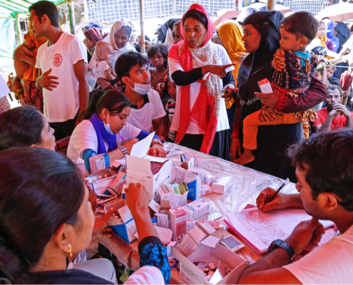
It’s stacked against them. Climate change is impacting developing countries in a real way, disrupting ancestral patterns used by the rural poor for farming, fishing, and daily life. On top of this, women and men experience climate change differently as gender inequalities worsen women’s coping. Women traditional are responsible for the tasks most likely to be affected by climate change: agriculture, food security, and water management.

How can women in these communities be empowered? For one, there needs to be a gender-responsive approach towards climate change policymaking and programming so that women can be important stakeholders when addressing climate change with their skills related to mitigation, adaption, and the reduction of risks.

A manual has been created for including women in the design process by the Global Gender and Climate Alliance (GGCA). CRiSTAL, which stands for Community-based Risk Screening Tool – Adaptation and Livelihoods, is designed to help project planners and managers integrate climate change adaption and risk reduction into community-level projects. It defines gender and includes warm-up activities and exercises that explain climate change that empower poor women to be powerful agents of change. The CRiSTAL approach also “provides a gender-specific vulnerability analysis for different parts of the population, highlighting the specific coping strategies of women, and resulting in clear pointers for how gender specific measures will need to be incorporated into projects.” From this manual, women gain access to knowledge about different hazards, risk reduction, resources and technology that reshape negotiations of comprehensive regimes on climate change. The manual includes examples of natural resource management projects focusing on drought coping strategies in Bangladesh, Mali, Nicaragua, Tanzania and Sri Lanka.

The manual concludes with a call for more government and NGO support, including providing skill transfer through ICT training for women that can change the perception of women in their communities.

Power generation accounts for about one-quarter of global carbon emissions, a major cause of global warming. CARMA (Carbon Monitoring for Action) was created to inventory and monitor this massive output to “equip individuals with the information they need to forge a cleaner, low-carbon future.” There are over 50,000 power plants and 4,000 power companies worldwide available on CARMA’s database, which is produced and financed by the Confronting Climate Change Initiative at the Center for Global Development. CARMA can be used by consumers, investors, shareholders, and policymakers to name a few for influencing decisions on power generation.

For power plants within the U.S., CARMA uses E.P.A. data. For non-reporting plants, CARMA estimates emissions using a statistical model that utilizes detailed data on plant-level engineering and fuel specifications. The database is updated quarterly to reflect changes in ownership, construction, renovation, planned expansions, and plant retirements. The plants can generate power from any number of sources, including hydroelectric, fossil fuels, and nuclear. According to the site, “CARMA does not endorse or favor any particular technology. Our goal is to simply report the best available information on sources of power sector carbon emissions.” In many cases data can be downloaded from the site.


WMO Information System boosts data exchange for disaster risk reduction,  forecasting, predictions and service delivery for food security and health

Last month the World Meteorological Organization released a new, more accessible and free international system that improves upon the current exchange of weather, climate and water data. The WMO Secretary-General, Michel Jarraud, said that “the WMO Information System is the pillar of our strategy for managing and moving weather, climate and water information in the 21st century.”


The WMO Information System, or WIS, connects and integrates information from three types of data centres:

  • National Centres collect and distribute data on a national basis. They generate quality controlled analysis and forecast products, and services, including archiving national climate information. The National Meteorological or Hydrological Service coordinate or authorize the use of the WIS by national users.
  • Data Collection or Production Centres are similar to National Centres but focus on thematic, regional or global collection and/or production of sets of data, forecast products, processed or value-added information, and/or for providing archiving services.
  • Global Information System Centres connect to each other through a high speed private network. They rapidly share information meant for routine global dissemination that they collect from National Centres and Data Collection or Production Centres in their area of responsibility . They also  serve as distribution centres into their areas of responsibilities. Global Information System Centres provide entry points, through unified portals and comprehensive metadata catalogues, for any request for data exchanged within the WIS. They also provide the connection to other information systems such as the Global Earth Observation System of Systems.

Photo Credit: CARPE

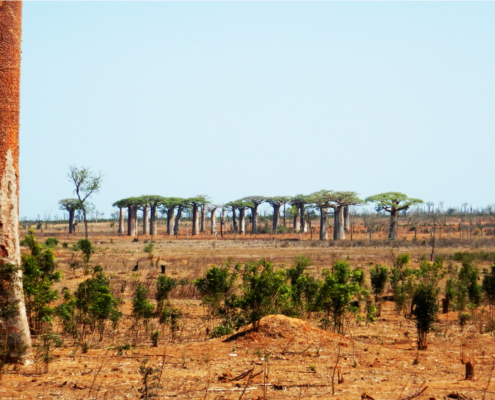
The Congo Basin is a critical tropical forest that supplies vital regional and worldwide ecological services. It is one of the largest tropical rainforests in the world, home to thousands of endemic plant and animal species such as lowland gorillas, chimpanzees, bonobos, and forest elephants. More than eighty million people depend on its abundance of timber and other natural resources for their livelihoods. A paradoxical note is that despite the richness of the Congo Basin, the people near it are some of the poorest in Africa. The forest is constantly cleared to make room for agricultural pursuits and to feed urbanized areas’ hunger for lumber. In addition to deforestation and forest degradation, illegal hunting and commercial bushmeat trade are major threats to biodiversity.

The Central African Regional Program for the Environment (CARPE) is a USAID longterm and regional initiative formed in 1995 in association with a consortium of government and NGO partners that concentrates its resources on six principal forested countries in Central Africa: Cameroon, Central African Republic, Democratic Republic of Congo, Equatorial Guinea,  Gabon, and the Republic of Congo. Uganda, Rwanda, Chad, Burundi, Rwanda and Sao Tome Principe are also involved in the initiative. CARPE is intended to be a 20-year process, resulting in complete local guidance. A major objective of CARPE is to protect forest resources by reducing degradation and protecting biodiversity. Modern tools such as Landsat satellite-derived maps, remote sensing, GIS, and geospatial databases are used for planning and monitoring of the forest. With this information, threatened species are under the protection of local communities and logging is controlled.


Prior to the development of CARPE, vast areas of the Congo Basin were unknown. Since then, a number of initiatives and activities have taken place, resulting in an overall evaluation in 2011. In this evaluation, CARPE was deemed extremely successful for introducing large-scale ecosystem management approaches. Tens of thousands of individuals have been trained in a variety of conservation methods and techniques. With   empowerment through such training and motivation that educates and organizes local groups to play an active role in forest and biodiversity conservation programs, civil society is being strengthened. This is seen as critical, circumventing the often inefficiently administered and economically weak centralized governments. The tools practiced allow for an understaffed patrol to communicate with a wider audience, limiting the “weak state management of these resources (that) creates a vacuum where local populations are often stripped of benefits as stronger or elite groups including private companies expropriate natural resources at sub-national and local levels.”Where will CARPE head in the coming years? The implementation of land use management plans for micro- and macro- zones, strengthening of government capacity and transparency are key.

Photo Credit: CDI and IRDC

The Centre for Development Informatics (CDI) at the University of Manchester with the support of the International Development Research Centre (IDRC) recently released a report on agricultural adaption for climate change. This report, “Using Radio to Improve Local Responses to Climate Variability,” focuses on a radio program made available to alpaca farmers in the Peruvian Andes.

Life of farmers in the Andes is difficult at times are made more volatile in light of climate vulnerability. Lately there have been unexpected cold spells coupled with heavy snowfall. Peru has the largest number of South American camelids (the animal group that includes llama, alpaca, vicuna and guanaco) in the world, providing a subsistence to 65,000 families at altitudes of 3,500 to 5,000 meters, where other forms of agriculture are impractical. With climate variations that have lead to below-average temperatures and water scarcity, there has been an increased death rate of livestock, the “main income source, this loss of animals condemns further those who are already living in conditions of severe poverty.”

The study notes a lack of adaptive capacity among farmers for short-term action. To address this, the CAMELTEC project was initiated from 2008 to 2010 by Peruvian NGO Desco with financial support of Oxfam GB.

CAMELTEC broadcasted technological, social, political, and institutional information with a heavy focus on meteorological warnings, market prices of alpaca wool and husbandry advice to remote communities. CAMELTEC also aired a weekly 20-minute broadcast called Amanecer Alpaquero (Alpaca Farmer’s Daybreak) that included more specific information and discussion on pertinent problems, the show “was popular with all members of Alpaca farming families not just because of the vital information provided, but also because of its use of humor and music in transmitting its message.”

Radio was chosen as the medium for engaging farmers because of its low setup, operating costs, and “the availability of cheap battery-powered AM radios means that the majority of Alpaca farming households have access to local radio broadcasts.” Radio is deemed the best option for communication because it has the best reception coverage in the andean topography where it has been “historically cost-prohibitive to construct infrastructure such as paved roads, electricity and fixed telecommunications up to the farmsteads.” Though most farmers have mobile phones, the utility is limited.


The CAMELTEC project had three goals:

– strengthen local organizations such as farmer-cooperatives to enable the introduction of sustainable (including climate-sustainable) livestock practices

– improve the quality and quantity of alpaca wool being produced, through good husbandry and reproductive management practices

– improve income through changes to wool output and through better market access


The project is deemed successful, decreasing livestock mortality by 12% and saving an equivalent of US $500 on average per farmer. Another benefit of the radio program was its access to females, addressing traditional gender barriers that make it difficult for women to be involved in community farming meetings. The program has encouraged “a more systematic approach to breeding, the utilization of farming cooperatives for marketing of alpaca wool, and a more commercial approach to farming; all of which have helped to either maintain or raise income levels.

Photo Credit: CDI and IRDC

What made CAMELTEC successful? “Deep local knowledge and experience were vital… building as it did on Demsco’s many years of working with local farmers” to gain trust and expertise. However the inability to deliver skill knowledge and the high price of batteries limited the project. The study concludes with the suggestion of strengthening radio programing related to climate change adaptation to improve institutional building.

With a wealth of options available to educators and practitioners alike, here are some of the best inexpensive mobile apps for young professionals and civic groups responsible for moderating the local environment and climate change.


Easy

SPARKvue – Winner of Tech & Learning Magazine’s 2010 Award of Excellence, SPARKvue brings real-time measurement, data visualization, and analysis to science education everywhere . Using Bluetooth interface, the application can connect to over 70 PASCO sensors for measuring pH, temperature, force, carbon dioxide levels, and many more. The app can be used by students to inquire, explore, and display data.


Moderate

Environmental Formulator – Environmental Formulator was created for environmental engineers and contains conversion formulas and 40-area calculations. Major areas covered in the program include: Air Quality, CFC, Cogeneration, Cost Benefit, Beach Pollution, Lake Pollution, River Pollution, Soil Pollution and Waste Conversions.


Difficult

eChartBook- Environmental Correction Chart Calculator – Designed to replace paper, the eChartBook Mobile offers access to Halliburton’s environmental correction algorithms wherever you are  for a complex array of sensors. The application also includes a number of useful general charts and tools for determining water saturation, borehole salinity, formation dip calculations, and cross plots.

Data Basin, an online system, is quickly growing in popularity among practicing educators and community groups that wish to tell compelling stories with graphics. Data Basin connects users with spatial datasets, tools, and expertise through a user-friendly platform where “individuals and organizations can explore and download a vast library of datasets, upload their own data, create and publish analysis, utilize working groups, and produce customized maps that can be easily shared.”

In a presentation on its potential, Jame Strittholt, Data Basin’s founder and Conservation Biology Institute‘s Executive Director called it Google Earth on steroids meets Facebook, allowing groups to communicate with each other by integrating conservation data, mapping, and people. The site contains groups for specific topics and issues and centers for targeted geographies. The core functions of Data Basin are free and a fee-based consulting service is available for those who wish to take full advantage of its features or store significant amounts of data. Currently a great variety of biological, physical, and socioeconomic data is available. Maps can be kept private, within groups, or open to the public.

Data Basin was created out of the need for a central access point for environmental conservation related datasets that people can explore. The tools are easy to understand and use, making it an excellent resource for nonprofessionals or those unfamiliar with ArcGIS. Data Basin was implemented by the Conservation Biology Institute in partnership with ESRI.

Amobilefuture released a free app called Pollution that features realtime air quality on an interactive geolocative regularly updated map for more than 1,380 cities worldwide. The app takes advantage of 100,000 base stations worldwide, allowing anyone to track measured exposures to electromagnetic, air and water pollution. It also monitors pollution and emissions to soil. It provides detailed lists of nearby pollutant facilities, with discharge details and volumes. The app’s purpose to to inform about the potential presence of pollutant sources in a comprehensive way.


Photo Credit: MarineBio


By some accounts tourism is the world’s largest industry, accounting for more than 10% of total employment. Tourism can have a negative impact on the environment by leading to the degradation of habitats and landscapes, depleting natural resources, and generating waste and pollution.

As a response to these concerns, ecotourism has grown in popularity because of its emphasis on being ecologically and socially conscious by raising awareness and support for conservation and local culture. Responsible ecotourism includes programs that minimize the adverse effects of traditional tourism on the natural environment and enhance the cultural integrity of the local people. Ecotourism has great potential for the developing world as communities come together and get involved, enforcing their own standards for sustainability.

So what is ecotourism 2.0? Ecotourism 2.0 seeks to fill the gaps that exist in ineffective organizing structures of ecotour communities. There are three main characteristics of ecotourism 2.0:


1. Engagement and Education – tourism doesn’t have to be passive and there can be a take-home message

2. Social Media – access and communication of information

3. Radical Transparency – clear organization within communities and with their visitors

Social media has thoroughly changed marketing techniques, now “people aggregate themselves around causes and products they believe in and age, sex and other demographic information is more and more irrelevant as this new media environment takes over.” It also allows for easy access to specific information and advice from locals, extending the experience beyond a vacation with updated news and reminders of key concepts.

Let’s look at successful social media campaigns:

LaosEcotourism Laos‘s website has Google Groups for donor organizations, government agencies, NGOs and the private sector to exchange information on current projects and issues relating to ecotourism development in Laos. The website allows for transparency and easy access to information and recommendation for visitors.

IndiaEcotourismkeralam.org provides access to information, specifically contact information for visitors to Kerala, India. Kerala is considered one of India’s most unspoiled corners prone to forest clearing.

KenyaEco Tourism Kenya is a multifaceted forum with updates and links to everything related to sustainable tourism.

Lebanon – This Baldati community is an ecotourism e-community for public announcements in the field.


How can ICTs be used to combat climate change? Stan Karanasios’s paper entitled “New & Emergent ICTs and Climate Change in Developing Countries” outlines emerging ICTs in 3 steps:

  • monitoring of climate change and the environment
  • disaster management
  • climate change adaptation
Excerpts from the paper outline uses of ICTs for climate change:

Monitoring of climate change and the environment

For developing countries to better understand their local climate and be able to anticipate climate change impacts, they must have adequate local and national observation networks, and access to the data captured from other global and regional networks. 

Types of technology include:

  • satellite systems
  • wireless broadband technologies
  • wireless sensor networks (WSN)
  • mobile phones
  • hand-held devices 
Examples of environmental monitors:
  • Rainfall and Landslide- In hilly regions of western India, SenSlide, a distributed sensor system, predicts rather than just detects landslides. Landslides occur frequently, often during the monsoon when rain causes significant damage. SenSlide makes use of WSN and strain gauges, providing data to a network.
  • Fire- In South Africa, FireHawk, a forest fire system of cameras with zoom lenses and microwave transmitters and receivers was implemented in mountainous and extreme temperate locations. The system automatically detects fires, even at night, limiting the impact of damage.
  • Flood- In Honduras, a WSN for flood monitoring was developed that was able to withstand river flooding and the severe stromes causing the floods, communicate over a 10,000 km river basin, predict flooding autonomously, and limit cost, allowing feasible implementation of the system.
  • Impacts of Agriculture- In India a WSN-based agriculture management system named COMMON-Sense Net, was deployed to support rain-fed agriculture and provide farmers with environmental data. Wireless sensors were deployed in geographical clusters, each with one base-station that was connected to a local server via a Wi-Fi link and organized in groups, each corresponding to a particular application, such as crop modeling, water conservation measures, or deficit irrigation management.

Disaster management

Responding to natural disasters in a timely and effective manner has emerged as an important climate change theme particularly in developing countries; where in addition to the immediate crisis vulnerable communities suffer excessively from the secondary post-disaster effects that compound the tragedy. In many cases, the existing telecommunication infrastructure will be significantly or completely destroyed by an extreme weather event, and hence rapidly deployable networks and other communication services need to be employed for disaster relief operations. 

Communication Methods:

  • Emergency Communication Systems- In Bangladesh an Integrated Information and Communication System is underway which will use satellite, wireless broadband, mobile phones and community radio services strengthening communication links between rescue and relief units and Emergency Operation Centers (EOC).
  • Rapidly Deployable Communications
  • Social Networking- During Typhoon Ondoy in the Philippines in 2009, local volunteers organized and disseminated information online through websites such as Facebook and Twitter. Organizations and affected people used these sites for timely reports concerning the extent of damage, to provide information on the resources required tand to allocate relief resources.
  • GIS & Other Information Systems- Visualize high risk zones; evacuation routes, shelters and the catalogue of available resource and their proximity
  • Early Warning Systems- satellite radio, mobile phones, cell broadcasting system, the web, WSNs, and CAP (common alerting protocol) can be coupled with climate data for immediate and short/medium/long-term warnings to minimize harm to vulnerable communities.

Disaster Management Project Example: Project DUMBO

Mesh Networks and Disaster Response in Thailand DUMBO,  a project initiated by  the Asian Institute of  Technology Internet Education and Research Laboratory, developed and tested asystem for response to emergency scenarios in Thailand . Making use of the concept of wireless mesh networks, DUMBO uses lightweight  portable mobile nodes  to  broaden  coverage and penetrate deep into  areas  not  accessible by  roads  or where the telecommunication  infrastructure  has  been  destroyed.  During  the trials in  Thailand, laptops  were carried on elephants to  extend thewireless  mesh  network  coverage.  On the networking  side,  the solution  utilised hybrid Wi­Fi and  satellite connectivity.  The second application component involved sensors, which allowed for  readings of  environmental data  such  as  temperature,  humidity,  pressure, wind­speed,  wind­ direction,  rainfall and  CO2.  The third application component involved facial recognition software that allowed rescuers to compare facial images captured from the site to the collection of known faces. This is one of a few systems in developing countries that  make use of  emergent  technologies  and  combine communications with integrated disaster applications

Climate change adaptation

To cope with current and future climate stress, communities – particularly those most vulnerable to developing countries – must build their resilience, including adopting appropriate technologies, while making the most of traditional knowledge, and diversifying their livelihoods. For instance, monitoring networks can inform habitat location (provide information to house communities away from a flood or landslide in prone areas), better agriculture (based on informed climate information or water allocation) and provide early warnings, amongst other applications. Mobile technology should be scaled-up for adaptation.

There is a lot of room for growth in developing ICTs for adapting to climate change through collecting, analyzing and disseminating information particularly in space-based systems, GIS, WSNs, wireless broadband technology, mobile technology, and soft technologies such as Web-based tools. By doing so, bottom-up local coping strategies will be encouraged.

Copyright © 2020 Integra Government Services International LLC