The partnership between Chad and Cameroon produces results; DRC faces broadband challenges.

Chad

Fibre optique: Le Cameroun et le Tchad désormais interconnectés (Fibre optics: Cameroon and Chad now interconnected) {La Nouvelle Expression}

Last week, Chad celebrated its connection to the SAT3 cable through Cameroon with three ceremonies. One, held in Chad, spoke to the need to reduce the digital divide. Another ceremony held in Cameroon, consisted of a video conference between Chadian President Idris Deby and his ambassador in Cameroon. Finally, the President demonstrated the international capabilities by Skyping through France. The project is the first milestone of the Central Africa Backbone which plans on filling a void in terrestrial connectivity in nations like Chad, Cameroon, and Central African Republic.

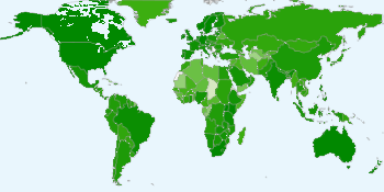
Kony 2012 traffic by countryPer traffic map for the recent Kony 2012 video, Chad (and Western Sahara) severely lag in broadband capacity. {YouTube}

Democratic Republic of Congo

Source: Fibre optique: la maffia bloque (Fiber optic: the mafia blocks it) {Digitalcongo.net}

After the WACS cable landed in Muanda in February 2011, the cable promised to be operational by the end of 2011. Since then, the country has dragged its feet. Apparently the project(s) will start and stop without much notice. That much is true to create a link to Kinshasa. Although, the author of this recent article blames the delays in projects on the mafia. Instead, delays seem to sprout from ineffective relationships between the Congolese Society of Post and Telecommunications (SCPT) and those responsible for public procurement of funds. Part of the problem has been the collapse of the incumbent Office Conolais des Postes et Telecommunications (OCPT). In essence, the government, overwhelmed with political problems, is less-than-effective in providing broadband. The private sector is more skilled, but gets blocked by government red tape.

US-based Carnegie Mellon University has announced the opening of a new regional centre for ICT in Rwanda, aimed at increasing science and technology development across East Africa.

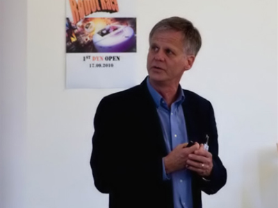
Carnegie Mellon University director in Rwanda Bruce Krogh

Carnegie Mellon University director in Rwanda Bruce Krogh. (image: cms.dyn.bci.tu-dortmund.de)

“Research and development in technology is now a global enterprise and Carnegie Mellon realised that education also needed to be a global enterprise to meet the demands of highly skilled engineers and innovators,” university director in Rwanda Bruce Krogh said.

Krogh said the west was not the sole source of technological breakthroughs anymore, “nor was it the dominant growth market for information and communication technology (ICT)”.

The university said they see East Africa as a beacon for ICT transformation, praising the region’s recent jumps in telecoms and IT infrastructure. Carnegie hopes to assist in continuing this success by bolstering ICT education.

He added that “for the case of Rwanda, there is a business-friendly, pro-ICT development program (Vision 2020) under which nation-wide fiber-optic cables will be installed throughout the country.”

Joseph Mayton

hands holding cell phone and looking through paperwork

Image: MMUBlog

A customers’ pattern of airtime top ups is being used to determine the credit-worthiness of a prospective borrower and approve/deny loans.  Will this technique facilitate the development of innovative micro-loans via the mobile channel?  Is the data truly an adequate predictor of customers’ ability to repay?  What’s the upside for the players involved?

Airtime based credit scoring in a nutshell

Most emerging markets have little to no infrastructure that adequately collects customers’ credit history: Credit bureaus either don’t exist, or exist on a limited number of individuals and with very thin financial data. For individuals without credit history, the result is stringent borrowing terms such as high collateral coverage, months of demonstrated savings, and/or individual or group guarantors.

The idea behind airtime based credit scoring is to use an individual’s history of airtime top up as a proxy indicator of what amount they can afford to borrow and their credit-worthiness.  The precise calculations and algorithms employed to do this is the “secret sauce” of Experian MicroAnalytics and Cignifi, two companies working in this space.

What does it take for this to work and what is the upside for those involved?


Models for Collaboration & Benefits

  • MNOsare the owners of the customer data, so for starters, they have to allow analytics firms access to build the predictive models.  (It is of course possible that in some countries, airtime top up aggregators have enough customer data for this business, or that an MNO chooses to build their own predictive models, but both of these seem less likely.) The MNOs presumably would only do so if they believed they could gain the following:
    • Increased customer loyalty – Depending on the exact terms of the loan, credit is typically a fairly attractive product offering and one with the potential to keep customers loyal.
    • Drive mobile money usage –Disbursing loans and collecting weekly loan repayments, can drive increased usage of mobile money platforms, leading to increased revenue.
    • Topline revenues – MNO data is typically used for internal analytics, but monetising the data for credit scoring produces topline revenue by leveraging an existing asset.
  • Financial institutions – The risk of the credit will always need to be underwritten by a financial institution i.e. bank or credit card company.  While there is certainly effort and risk involved to getting the model right, they have three things to gain if it works:  1) ability to reach a customer segment not previously accessible 2) improved ability to target the right product at the target customer i.e. loan size appropriate to the clients ability to repay and 3) revenues from loans
  • Data analytics company / credit agencies – The models take time to develop before they are truly good predictors of credit worthiness, but if these firms get it right, they earn money on the valuable models they have built and hold a key position sitting between MNOs and financial institutions, who otherwise may not want to share data.
  • Customer – It is the customer and the customer alone who applies for a loan and gives the ok for a company to use their airtime patterns in the approval process.  The client benefits from access to “instant decision” low value loans, which can be used to smooth monthly cash flows.

What do you think? Will MNOs use this technique to develop and offer innovative mobile money micro-loans? Will stakeholders work together to offer this service?  Is there demand from the unbanked?

Check back next week for guest posts from Experian MicroAnalytics and Cignifi on their work to date in this area.

Instead of a post on how Malians are using social media to promote the now-delayed April 29th, 2012 presidential elections, we turn to see how social media has been used to spread information of a military coup on March 22, 2012.

Screenshot of collection of Youtube videos from MaliBy now, word is out that Malian army officers toppled President Amadou Toure’s government and suspended the constitution over the state’s handling of a Touareg rebellion in northern Mali. Something seemed amiss when the official Twitter account of Amadou Touré, the Malian President, denied a coup attempt and then went silent after days of consistent Tweets.

Most Malians may not use the Internet, but that doesn’t mean the Internet can’t provide the outside world with a glimpse of what is happening in the streets of Bamako. In fact, this marks the first time the world has been able to watch military leaders speak to the public immediately following a transfer of power. Within a day, videos from state TV were already on YouTube. To some degree, it is surreal to watch a group of Malian soldiers in fatigues calmly address a frightened nation after they eliminated democratic rule moments before. In the video below, the army explains why they felt a coup was necessary and then cites goals of empowering the army to unify all cities & organize free and transparent elections as soon as possible.

Since Wednesday’s coup, a handful of journalists, Malians, and media outlets have commented in real-time on events in Bamako. Kudos to CPJ for such quick analysis, MaliActu.net for such unique video, and Tommy Miles for his unmatched coverage:

  • Perhaps the best review of how word of the coup spread online comes from Mohamed Keita, Africa Advocacy Coordinator for the Committee to Protect Journalists. He has written an in-depth look on how social media spread news of the coup, with dozens of sources. His conclusion: traditional media is limited in times of fast-breaking news.
  • Mali Actualités, a Malian news site has released recent video from state TV ORTM onto YouTube. Six videos totaling 6,000 views have been uploaded since the coup (one is embedded at the top of this post).
  • Tommy Miles, a self-described “West Africa watcher” has created a list of 20 Twitter accounts to follow for news about Mali. He has posted and re-tweeted more than one hundred pieces of information. Especially interesting are how the Mauritania government supposedly supports the Malian coup, transcripts from TV announcements, and links to media articles.
  • GlobalVoices has posted a dozen or so Twitter reactions from Malian citizens. The consensus: great surprise by the recent events.
  • Phil Paoletta, an American living in Bamako has provided a steady stream of observations. One of the most interesting is how state TV so casually alternates from military speech to music videos.
  • Jules Cavendish, a reporter for a variety of international publications, happens to be in Bamako and has provided poignant commentary on the situation (ie. “Could the irony of Toure’s legacy be that democracy only lasted as long as he was around?”)
  • Martin Vogl, freelance journalist working for the BBC and AP, was considered one of the most credible resources for international media to cite.
  • Fabien Offner, a West African journalist, made a couple of updates, including how one presidential candidate’s home was vandalized.
  • Bruce, an expat living in Bamako, has posted detailed accounts of his past couple of days on his WordPress blog, including insights from the US Embassy.
  • MaliJet has extensive coverage of the news, plus dozens of reactions and some images as does Journal du Mali.
  • Hashtags have included #Bamako #Mali #ORTM #SanogoShow.

The military claims to have formed a transitional council that will organize elections. The group also plans to restore power to a democratically elected leader, but a date has not been set. A shame, considering democratic elections were only a month away…

Note: Although state television and state radio were taken over (as is protocol for African military coups), the Internet was not explicitly shut-down.

Photo Credit: TodayHeads.com

Remember “Hooked on Phonics“?  The famous infomercials from the 90’s that promised an educational video series could improve children’s reading scores through phonic-based learning methods?

GraphoGAME, a digital-based phonics learning game developed in Finland, is proving to be just as effective for children in low-income countries and as easily accessible through an array of ICT devices.  Developed at the Agora Human Technology Center of the University of Jyväskylä in collaboration with the Niilo Mäki Institute, the game has already been developed in numerous languages — Bantu Languages in Africa, English, Spanish, Chinese, Arabic, Hindi, etc. — to improve literacy where access to sources of high-quality education is limited.

GraphoGAME promotes literacy development by teaching children to form letter-sound associations instead of simply memorizing letter symbols and names.  By using fun and entertaining activities, the child becomes engaged and progresses as the game becomes increasingly difficult according to their progress.  It starts by introducing basic sounds and gradually progresses to complicated sound combinations.

The research team and developers didn’t design GraphoGAME to replace the role of teachers in literacy learning, but instead promote its value as a powerful learning aid when placed in an educational setting where there are challenges to literacy development.  For example, it would be a valuable resource in classrooms where teachers use rote learning — often considered a barrier to meaningful learning and is pervasive throughout the developing world.

The idea for GraphoGAME was introduced in the early 1990’s after Finnish researcher, Heikki Lyytinen, conducted a series of studies on children with dyslexia to identify predictors that could anticipate problems in literacy education.  Using these findings and with funding from the Finnish Ministry of Education and Culture, the research team developed the first version of the educational game for children in Finland, and in 2011 expanded the project to address illiteracy in other countries.

Image from GraphoGAME

To support the expansion, the GraphoGAME developers created a larger project called the Grapho Learning Initiative which is divided into four focus areas: GraphoGAME, GraphoWORLD, GraphoREAD, and GraphoLEARN.

GraphoWORLD is a network of university professors and researchers from around the world who are working together to develop non-commercial technologies to improve literacy.  In order to address each country’s unique orthography (system of spelling) and general learning environment, researchers conduct studies and assessments to support the effictiveness of GraphoGAME within that particular country.

GraphoREAD is a promising research project on eReading platforms and the business models to support them within low-income countries. This is a valuable addition to the GraphoGAME project and the research team is working to ensure that high-quality reading materials are made available for children developing literacy skills.

GraphoLEARN is an entity that will be created after the GraphoREAD research is completed and analysed to support the production of the learning materials identified in the research.

There are a number of videos online that can offer a brief introduction to the format of the games and the educational philosophy behind them.  You can also go to the GraphoGAME website to try some of the games yourself.

The Africa Soil Information Service (AfSIS) makes one wonder how people coped before it existed. Africa Soil offers an enormous abundance of peer-to-peer information and services, namely data and maps that are georeferenced. The site fills a much needed gap because knowledge about the condition of African soils because it tends to be fragmented and outdated. AfSIS aims at giving the tools needed to maintain the health of the soil resource base as science and technological developments in remote sensing are providing new opportunities for low cost and efficient applications such as digital soil mapping, infrared spectroscopy, remote sensing, statistics, and integrated soil fertility management. Through such efforts areas of risk can be predicted and monitored.The Globally Integrated Africa Soil Information Service (AfSIS) is a “large-scale, research-based project to  develop a practical, timely, and cost-effective soil health surveillance service to map soil conditions, set a baseline for monitoring changes, and provide options for improved soil and land management in Africa.”

AfSIS’s efforts of dissemination and training allow access to farm communities, public and private extension services, national agricultural research and soil survey organizations, the fertilizer sector, project and local planners, national and regional policymakers,and scientists. It is used in Kenya, Tanzania, Malawi, Mali, Nigeria, Ethiopia, Mozambique, and Ghana in partnership with several academic institutions. Through the success of the project , a global mapping effort has emerged.

Some impressive activities include:

  • producing digital soil maps and environmental covariates
  • developing, implementing and maintaining the cyber-infrastructure to operate this effort
  • developing a spatial database of soil management experiments
  • linking the soil management info to the digital maps
  • developing information dissemination mechanisms including websites, method manuals and guidelines, policy brief and a digital atlas
  • mainstreaming the soil health information system

Telecom operator Orange Kenya has asked the government for a KES 10 billion ($120 million) bailout, news reports revealed on Wednesday. The move comes as the company continues to incur massive debts following its 2007 buyout by France Telecom.

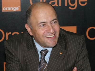
Orange Kenya CEO Mickael Ghossein.

Orange Kenya CEO Mickael Ghossein. (image: file)

Orange made a record loss of KES 18.2 billion in 2011 and needs to raise KES 5.8 billion in order to repay bank loans by the end of the month.

According to documents published online, Orange Kenya’s management said it has hit a “brick wall”. They warn the Kenyan Treasury and France Telecom, that if the emergency cash injection failed to arrive, the operator would be unable to meet its immediate commitments (about KES 1.6 billion) to Standard Chartered Bank.

According to analysts this, “will trigger a chain reaction that could see bank loans worth KES 12.5 billion from Standard Chartered and KCB called in”.

The company added that they would only be able to cover basics like electricity, water, security and salaries.

Orange Kenya CEO Mickael Ghossein said in a statement yesterday, that the total amount of shareholder loans being requested “was still under discussion”.

Joseph Mayton

Aero jet on the tarmac

Aero Airlines. (image: newsdiaryonline.com)

West Africa’s oldest aviation company Aero Contractors has introduced a mobile payment system on the Universal Message Object (U-MO) platform.

U-MO is a mobile money service enabling users to make and receive payments, and conduct other financial transactions on their mobile phones.

This service enables users pay for their Aero flight tickets via their mobile phones.

According to Aero MD Akin George, “This new service is going to revolutionise how people purchase their airline tickets and what they expect from their airline.”

The new payment option aims to increase operational efficiency, save money for the airline and ultimately decongest the airline’s reservation offices.

Segun Adekoye

Save the Elephants is celebrated for its conservation work in Kenya, Congo, Mali, and South Africa. The four pillars of Save the Elephants are research, protection, grassroots, and education. Each of these pillars is taken seriously in a comprehensive way, keeping in mind that the ultimate approach to conservation is through local knowledge and understanding the elephant’s perspective.

Save the Elephants has used tracking technology since the mid-1990s. The Elephant Tracking Project displays movement patterns and corridors by using ESRI software that verifies GPS data. The tracking device also allows for a Quick Response Unit that notes any disturbances that might signal poaching. An integral part of Save the Elephants’ tracking and research is based off of data collected by GPS/GSM collars that send text messages every couple of hours that contain details on their location, air temperature, and humidity. Currently there are over eighty collars in rotation.

Tracking patterns can be viewed in Google Earth on a moving 3D  backdrop of satellite photos provided by Digital Globe. On top of these tracking images of migratory patterns, stories and events are attached for interaction and educational purposes. Through such tracking, researchers are better able to understand why elephants do what they do and the complex social structures in which they live. Researchers can infer on how the relationship between human settlements and water resources affect elephant movements. By tracking these patterns, protected corridors have been established.


Photo Credit: Save the Elephants


An interesting project that Save the Elephants has taken on is geofencing. Traditional fences can be very costly and often ineffective in deterring bull elephants from raiding small-scale agriculture near human settlements. Geofences send an SMS message to an animal management team when a collared elephant passes through it. The team then can chase the elephant out of the fields and train it through negative reinforcements not to pass through the fence again. The program is being refined to teach elephants where they can’t go and to inform farmers of potential night-raids.

Another project is called SEARS (Spatial Economics and Remote Sensing of Elephant Resources). The organization created a vegetation map of Samburu to monitor migration patterns and the distribution of individual species of vegetation. Through layering the data, researchers can note the size and nutritional value of the vegetation. The goal of this project is to better understand why elephants migrate according to specific corridors and between specific regions. Save the Elephants notes how drastically migratory routes change when there are abrupt transformations in weather norms.

Save the Elephants rejoices in the explosion of communications and technology that allow the outside world to experience remote areas. The organization regularly engages with schools and provides media on their webpage.

MSF doctor kneels next to young girl with cast on her leg

Photo: MSF

By Médecins Sans Frontières

As a project manager for MSF (Médecins Sans Frontières/Doctors Without Borders), a medical emergency humanitarian agency, I attended this year’s South by Southwest (SXSW) festival in Austin, Texas, in the company of a friend and collaborator from Google who is involved in crisis mapping. We gave a presentation on some mapping work we had done together, and inevitably we discussed the differences and similarities in our geek (high-technology) and primitive fieldworker (humanitarian) cultures.

The two cultures are, on the face of it, rather distinct.

Geeks live in highly connected environments, usually urban, surrounded by technological infrastructure straight from the most outrageous science fiction of decades past. They inhabit an intellectual world of abstractions: math, code, logic, creativity, and business; while their physical existence is supported by a seamless layer of luxury and connectivity. The food, and the coffee, is good.

Humanitarian fieldworkers live a variety of environments from luxury hotels or palatial mansions to mud huts or tents, with variable connectivity, but almost always with constraints. Even in the most modern of African or South Asian capitals the technological infrastructure is often wobbly; there may be high-speed internet but it usually features random periods of downtime. In the mud hut scenario, internet and telephone use generally involves a satellite rig, great expense, and substantial cursing at the fiddly configurations and on-again-off-again unreliability. Our lives are never far abstracted from the constant effort required to enable working conditions, and the intensely pragmatic work of solving immediate problems. That patient is in danger of dying NOW, that refugee camp needs clean water NOW, and if we don’t get the car fixed in the next few hours we’ll be spending the night by the riverbank eating dry emergency ration biscuits. Most of us have at one time or another shared a single broken-down laptop with several people, a leaky thatched roof over a mud floor, and a plate of sandy, oily rice that is as good as we’re going to get for dinner.

Despite these disparate viewpoints (abstraction vs. immediate physical pragmatism) and differing ecological niches (urban café vs. mud hut) there is an unexpected similarity; primitive fieldworkers and geeks share a culture of problem-solving. Nothing makes a geek happier than a tough problem that gets all the neurons firing, and nothing makes a fieldworker happier than a serious emergency that gets the adrenaline flowing (if that sounds callous, in our defence it’s not the suffering that we enjoy, but the chance to make a real difference with our work).

At SXSW we had the chance to share that cultural crossover with a broad audience of geeks, fieldworkers, and an assortment of others, all of whom shared an interest in the intersection of humanitarian work and technology.

My main take-home message was: we are not alone.

We humanitarians tend to take pride in our ability to deal with problems by stretching our ingenuity and using only what is available in the field. My friend from Google was astounded at what we do with spreadsheets, saying “I didn’t think that this could be done without software coding capacity”. We use spreadsheets as databases, stock management systems, maps, payroll systems, and sketchpads. This is, perhaps a strength but I am beginning to realize that we take it too far. There is an enormous community out there in the world, with increasingly robust electronic links to even the most remote field locations, who can help us. Open source code can be written to address problems that we would normally tackle with tortuous repurposing of spreadsheets; there are incredibly talented programmers delighted to donate their efforts, especially to interesting problems. Informal slums can be mapped by volunteers, either people who once lived in the country or even by people who have never been there simply hand-tracing satellite imagery. The astounding success of the Ushahidi project (follow the link to read about an open-source crisis mapping project that started in Kenya to assist people during electoral violence and has since been used around the world, including Washington DC, to map emergencies) shows the power of crowdsourcing or distributed voluntarism to assist people in crisis.

Humanitarians need tools and information, particularly during crises. The tech world is bursting with possibilities to provide just that, often free of charge and with an astonishing level of professionalism. I hope that this meeting of cultures continues to deepen and that the early promise of these innovations translates to real benefit to the populations in crisis that we serve.

Ivan Gayton

Ivan Gayton is a project manager with Médecins Sans Frontières, currently working in Nigeria. During the Haiti cholera outbreak in 2010, he worked together with a team from Google to develop tools to map the outbreak using freely available software (Google Earth). He and Google’s Pablo Mayrgundter continue to work on an open-source epidemiological mapping tool in their scant spare time. Other than an interest in seeing further cultural cross-pollination between humanitarians and techies, Ivan has no conflict of interest, and no financial interests whatsoever in the matter.

This and many other MSF blogs are available at PLoS – Speaking of Medicine http://blogs.plos.org/speakingofmedicine/category/msf-2/
Copyright © 2020 Integra Government Services International LLC