Tag Archive for: mapping

Integration of environmental data is critical for water. WISDOM, a Vietnamese-German project, is an inspirational model of how watershed management leads to sustainable use and preservation of water resources. WISDOM combines information from hydrology, sociology, information technology, and earth observation for its implementation of an Information System for the Mekong Delta.

The Mekong Delta struggles against population increase, changing climatic conditions, and regulatory measures. Because of these challenges, extreme flood events occur more frequently, drinking water availability is increasingly limited, soils show signs of salinization or acidification and species and complete habitats are diminishing.

WISDOM’s integrated information system contains available and newly generated data from multiple disciplines, open to users through an accessible query. The IS allows a feed of input from remote sensing, GIS, digital maps, in-situ, interpolated point measurements, and other sources. Available data includes flood and drought risk, water quality, sediment load, discharge, and land use changes.

Lessons learned from this initiative include that the cooperation of national institutes and regional or local authorities needs to be strengthened. Successes include the knowledge transfer provided between German institutions and Vietnamese doctorate candidates and the user-friendliness of the IS that can answer specific and complex questions that support regional planning activities.


New Agriculturist
reports that International Small Group & Tree Planting Program (TIST) has begun to train over 50,000 farmers in eastern Kenya on carbon trading. TIST reports that it has planted over six million trees in Kenya. TIST is involved in tree planting ventures across Africa and Asia.

In this particular initiative, TIST acts as a broker between farmers with trees and individuals or companies who wish to offset their carbon footprint. TIST trains locals to track farmers’ trees using hand-held computers and GPS devices. The trained locals record the location, number, size, species, and take photos that are uploaded and posted online. Three to six months after planting, a tree is eligible for carbon credits that earn farmers 1.50 shillings (US $0.02) per tree annually.

Besides monetary benefit, the tree planting also provides farmers more secure water storage during rain and drought and aid soil health and fertility. TIST is thrilled with the results of this initiative, which are leading to more sustainable land management practices.


The Africa Soil Information Service (AfSIS) makes one wonder how people coped before it existed. Africa Soil offers an enormous abundance of peer-to-peer information and services, namely data and maps that are georeferenced. The site fills a much needed gap because knowledge about the condition of African soils because it tends to be fragmented and outdated. AfSIS aims at giving the tools needed to maintain the health of the soil resource base as science and technological developments in remote sensing are providing new opportunities for low cost and efficient applications such as digital soil mapping, infrared spectroscopy, remote sensing, statistics, and integrated soil fertility management. Through such efforts areas of risk can be predicted and monitored.The Globally Integrated Africa Soil Information Service (AfSIS) is a “large-scale, research-based project to  develop a practical, timely, and cost-effective soil health surveillance service to map soil conditions, set a baseline for monitoring changes, and provide options for improved soil and land management in Africa.”

AfSIS’s efforts of dissemination and training allow access to farm communities, public and private extension services, national agricultural research and soil survey organizations, the fertilizer sector, project and local planners, national and regional policymakers,and scientists. It is used in Kenya, Tanzania, Malawi, Mali, Nigeria, Ethiopia, Mozambique, and Ghana in partnership with several academic institutions. Through the success of the project , a global mapping effort has emerged.

Some impressive activities include:

  • producing digital soil maps and environmental covariates
  • developing, implementing and maintaining the cyber-infrastructure to operate this effort
  • developing a spatial database of soil management experiments
  • linking the soil management info to the digital maps
  • developing information dissemination mechanisms including websites, method manuals and guidelines, policy brief and a digital atlas
  • mainstreaming the soil health information system

Save the Elephants is celebrated for its conservation work in Kenya, Congo, Mali, and South Africa. The four pillars of Save the Elephants are research, protection, grassroots, and education. Each of these pillars is taken seriously in a comprehensive way, keeping in mind that the ultimate approach to conservation is through local knowledge and understanding the elephant’s perspective.

Save the Elephants has used tracking technology since the mid-1990s. The Elephant Tracking Project displays movement patterns and corridors by using ESRI software that verifies GPS data. The tracking device also allows for a Quick Response Unit that notes any disturbances that might signal poaching. An integral part of Save the Elephants’ tracking and research is based off of data collected by GPS/GSM collars that send text messages every couple of hours that contain details on their location, air temperature, and humidity. Currently there are over eighty collars in rotation.

Tracking patterns can be viewed in Google Earth on a moving 3D  backdrop of satellite photos provided by Digital Globe. On top of these tracking images of migratory patterns, stories and events are attached for interaction and educational purposes. Through such tracking, researchers are better able to understand why elephants do what they do and the complex social structures in which they live. Researchers can infer on how the relationship between human settlements and water resources affect elephant movements. By tracking these patterns, protected corridors have been established.


Photo Credit: Save the Elephants


An interesting project that Save the Elephants has taken on is geofencing. Traditional fences can be very costly and often ineffective in deterring bull elephants from raiding small-scale agriculture near human settlements. Geofences send an SMS message to an animal management team when a collared elephant passes through it. The team then can chase the elephant out of the fields and train it through negative reinforcements not to pass through the fence again. The program is being refined to teach elephants where they can’t go and to inform farmers of potential night-raids.

Another project is called SEARS (Spatial Economics and Remote Sensing of Elephant Resources). The organization created a vegetation map of Samburu to monitor migration patterns and the distribution of individual species of vegetation. Through layering the data, researchers can note the size and nutritional value of the vegetation. The goal of this project is to better understand why elephants migrate according to specific corridors and between specific regions. Save the Elephants notes how drastically migratory routes change when there are abrupt transformations in weather norms.

Save the Elephants rejoices in the explosion of communications and technology that allow the outside world to experience remote areas. The organization regularly engages with schools and provides media on their webpage.

Power generation accounts for about one-quarter of global carbon emissions, a major cause of global warming. CARMA (Carbon Monitoring for Action) was created to inventory and monitor this massive output to “equip individuals with the information they need to forge a cleaner, low-carbon future.” There are over 50,000 power plants and 4,000 power companies worldwide available on CARMA’s database, which is produced and financed by the Confronting Climate Change Initiative at the Center for Global Development. CARMA can be used by consumers, investors, shareholders, and policymakers to name a few for influencing decisions on power generation.

For power plants within the U.S., CARMA uses E.P.A. data. For non-reporting plants, CARMA estimates emissions using a statistical model that utilizes detailed data on plant-level engineering and fuel specifications. The database is updated quarterly to reflect changes in ownership, construction, renovation, planned expansions, and plant retirements. The plants can generate power from any number of sources, including hydroelectric, fossil fuels, and nuclear. According to the site, “CARMA does not endorse or favor any particular technology. Our goal is to simply report the best available information on sources of power sector carbon emissions.” In many cases data can be downloaded from the site.


This is a guest post from Jamie Lundine, who has been collaborating with Plan Kenya to support digital mapping and governance programming in Kwale and Mathare. The original was published on Jamie’s blog, titled Information with an Impact. See part 1 of this series here: Digital Mapping and Governance: the Stories behind the Maps.

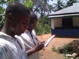
Mapping a school near Ukunda, Kwale County

Creating information is easy. Through mobile phones, GPS devices, computers (and countless other gadgets) we are all leaving our digital footprints on the world (and the World Wide Web). Through the open data movement, we can begin to access more and more information on the health and wellbeing of the societies in which we live. We can create a myriad of information and display it using open source software such as Ushahidi, OpenStreetMap, WordPress, and countless other online platforms. But what is the value of this digital information? And what impact can it have on the world?

Youth Empowerment Through Arts and Media (YETAM) is project of Plan International which aims to create information that encourages positive transformation in communities. The project recognizes young people as important change agents who, despite their energy and ability to learn, are often marginalized and denied opportunities.  Within the YETAM project, Plan Kenya works with young people in Kwale County (on the Coast of Kenya) to inspire constructive action through arts and media – two important channels for engaging and motivating young people.

Information in Kwale County

Kwale County is considered by Plan International to be a “hardship” area. Despite the presence of 5-star resorts, a private airport and high-end tourist destinations on Diani beach, the local communities in Kwale County lack access to basic services such as schools, health facilities and economic opportunities. Young people in the area are taking initiative and investigating the uneven distribution of resources and the inequities apparent within the public and private systems in Kwale County.

As one component of their work in Kwale, Plan Kenya is working with the three youth-led organizations to create space for young people to participate in their communities in a meaningful, productive way. There are different types of participation in local governance – often times government or other agencies invites youth to participate (“invited space”) as “youth representatives” but they are simply acting to fill a required place and are not considered  within the wider governance and community structures.

Youth representation can also be misleading as the Kwale Youth and Governance Coalition (KYGC) reports that “youth representatives” aren’t necessarily youth themselves – government legislation simply stipulates that there must be someone representing the youth – but there is no regulation that states that this person must be a youth themselves (they must only act on behalf of the youth). This leaves the system open to abuse (the same holds true for “women’s representative” – you can find a man acting on behalf of women in the position of women’s representative).  Plan Kenya and the young people we met are instead working to “create space” (as opposed to “a place”) for young people in community activism in Kwale County.

The 5 weeks we spent in Kwale were,the beginning of a process to support this on-going work in the broad area of “accountability” – this encompasses child rights, social accountability and eco-tourism. The process that began during the 5 weeks was the integration of digital mapping and social media to amplify voices of young people working on pressing concerns in the region.

To create the relevant stakeholders and solicit valuable feedback during the process of the YETAM work on digital mapping and new media, our last 3 days in Kwale were spent reviewing the work with the teams. On Thursday November 10th, we invited advisors from Plan Kwale, Plan Kenya Country Office, the Ministry of Youth Affairs and officers from the Constituency Development Fund to participate in a half-day of presentations and feedback on the work the young people had undertaken.

By far the work that generated the most debate in the room was the governance tracking by the KYGC. The team presented the Nuru ya Kwale blog which showcased 28 of the 100 + projects the youth had mapped during the field work. They classified the 28 projects according to various indicators – and for example documented that 23 of the projects had been completed, 1 was “in bad progress”, 2 were “in good progress” and 1 “stalled.”

The CDF officers (the Chairman, Secretary and Treasurer of the Matuga CDF committee in Kwale County) were concerned with the findings and questioned the methodology and outcome of the work.  They scrutinized some of the reports on the Nuru ya Kwale site and questioned for example, why Mkongani Secondary School was reported as a “bad” quality project. The officials wanted to know the methodology and indicators the team had used to reach their conclusions because according to the representatives of the CDF committee, the auditors gave the Mkongani Secondary School project a clean bill of health.

One important message for the youth based on feedback on their work was the need to clearly communicate the methodology used to undertake the documentation of projects (i.e. what are the indicators of a project in “bad” progress? how many people did you interview? Whose views did they represent?).

There is significant value in presenting balanced feedback that challenges the internal government (or NGO) audits – for example the data on Kenya Open Data documents that 100% of CDF money has been spent on the Jorori Water Project mentioned above, but a field visit, documented through photos and interviews with community members reveals that the project is stalled and left in disrepair. This is an important finding – the youth have now presented this to the relevant CDF committee. The committee members were responsive to the feedback and, despite turning the youth away from their offices the previous month, invited them to the CDF to get the relevant files to supplement some of the unknown or missing information (i.e. information that people on the ground at the project did not have access to, such as for example, who was the contractor on a specific project, and what was the project period).

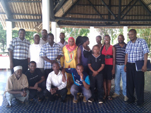
Kwale youth with staff from Plan Kenya, officers from the CDFC and the local Youth Officer

Samuel Musyoki, Strategic Director of Plan Kenya who joined the presentations and reflections on November 10th and 11th, reported that:

“The good thing about this engagement is that it opened doors for the youth to get additional data which they needed to fill gaps in their entries. Interestingly, they had experienced challenges getting such data from the CDF. I sought to know form the CDFC and the County Youth Officer if they saw value in the data the youth were collecting and how they could use it.

The County Youth Officer was the most excited and has invited the youth to submit a business proposal to map Youth Groups in the entire county. The mapping would include capturing groups that have received the Youth Enterprise Fund; their location; how much they have received; enterprises they are engaged in; how much they have repaid; groups that have not paid back; etc. He said it will be an important tool to ensure accountability through naming and shaming defaulters.

The 5 weeks were of great value — talking to quite a number of the youth I could tell — they really appreciate the skill sets they have received-GIS mapping; blogging; video making and using the data to engage in evidence based advocacy. As I leave this morning they are developing action plans to move the work forward. I sought assurance from them that this will not end after the workshop. They had very clear vision and drive where they want to go and how they will work towards ensuring sustained engagement beyond the workshop.”

The impact of digital mapping and new media on social accountability is still an open question. Whether the social accountability work would have provoked similar feedback from duty bearers if presented in an offline platform (for example in a power point presentation) instead of as a dynamic-online platform is unknown.

The Matuga CDF officers were rather alarmed that the data were already online and exposed their work in an unfavourable light (in fairness, there were some well-executed projects as well). There is a definite need to question the use of new technology in governance work, and develop innovative methods for teasing out impact of open, online information channels in decision-making processes and how this is or isn’t amplifying existing accountability work.  There is definite potential in the work the young people are undertaking and the government officers consulted, from the Ministry of Youth Affairs and local CDF Committee (CDFC) stated that they were “impressed by the work of the youth”.

Within the community development systems and particularly the structure of devolved funding, there is a gap in terms of monitoring and evaluation (M&E) that the CDF committee to date has not been able to play effectively. As Samuel Musyoki stated the youth “could watch to ensure that public resources are well utilized to benefit the communities.” The Youth Officer even invited the youth to submit proposals for assistance in buying GPS gadgets and computers to strengthen this work.

Continuing the on and offline integration

As discussed, the work in Kwale on various issues is dynamic and evolving. The 5 weeks we spent with the teams were meant to provide initial trainings and support and to catalyse action that would be continued by the youth in the area, with support from Plan Kenya. Not only did we provide training to the young people, but Plan Kwale staff were also involved in the process and started documenting their work through the tools and techniques introduced by our team. With these skills, the Plan Kwale staff will support the on-going field mapping and new media work. We are also available to provide remote assistance with questions about strategies and technical challenges.

Some of the future activities include:

  • Holding a “leaders forum” during which the youth interact with a wider cross-section of stakeholders and share their work.
  • Continuing work on their various websites – updating the sites with results from social auditing work to be carried out throughout the last weeks of November, as well as digitizing previous information collected during historical social auditing.
  • Validating the data by revisiting some project sites and documenting projects that haven’t been done yet, gathering stories from some of the Project Management Committees, taking more photos, and potentially conducting surveys within the communities to get more representative views on project evaluations.
  • Each group also needs to develop a more structured advocacy strategy to direct their activities in these areas.
  • All teams expressed interest in developing proposals to submit to the Ministry of Youth Affairs, through the Youth Enterprise Fund and CDF Committee, based on the suggestion of potential funding for this process. Plan Kwale staff, as well as some of the Country Office advisers offered to support the youth in developing these proposals.
  • Most importantly, the teams want to consult the wider community in their respective areas to demonstrate the relevance of YETAM, including the skills they have gained, to the community stakeholders (beyond the relevant government authorities

The potential of new technologies, including digital mapping to promote accountability, is only as powerful as the offline systems into which it is integrated. Without offline engagement, existing community systems of trust and recognition will be threatened and thus undermine any online work. The youth must remain grounded within their existing work and use new technology to amplify their voices, build their network, share their stories and lessons and learn from and engage with others.

Photo Credit: CARPE

The Congo Basin is a critical tropical forest that supplies vital regional and worldwide ecological services. It is one of the largest tropical rainforests in the world, home to thousands of endemic plant and animal species such as lowland gorillas, chimpanzees, bonobos, and forest elephants. More than eighty million people depend on its abundance of timber and other natural resources for their livelihoods. A paradoxical note is that despite the richness of the Congo Basin, the people near it are some of the poorest in Africa. The forest is constantly cleared to make room for agricultural pursuits and to feed urbanized areas’ hunger for lumber. In addition to deforestation and forest degradation, illegal hunting and commercial bushmeat trade are major threats to biodiversity.

The Central African Regional Program for the Environment (CARPE) is a USAID longterm and regional initiative formed in 1995 in association with a consortium of government and NGO partners that concentrates its resources on six principal forested countries in Central Africa: Cameroon, Central African Republic, Democratic Republic of Congo, Equatorial Guinea,  Gabon, and the Republic of Congo. Uganda, Rwanda, Chad, Burundi, Rwanda and Sao Tome Principe are also involved in the initiative. CARPE is intended to be a 20-year process, resulting in complete local guidance. A major objective of CARPE is to protect forest resources by reducing degradation and protecting biodiversity. Modern tools such as Landsat satellite-derived maps, remote sensing, GIS, and geospatial databases are used for planning and monitoring of the forest. With this information, threatened species are under the protection of local communities and logging is controlled.


Prior to the development of CARPE, vast areas of the Congo Basin were unknown. Since then, a number of initiatives and activities have taken place, resulting in an overall evaluation in 2011. In this evaluation, CARPE was deemed extremely successful for introducing large-scale ecosystem management approaches. Tens of thousands of individuals have been trained in a variety of conservation methods and techniques. With   empowerment through such training and motivation that educates and organizes local groups to play an active role in forest and biodiversity conservation programs, civil society is being strengthened. This is seen as critical, circumventing the often inefficiently administered and economically weak centralized governments. The tools practiced allow for an understaffed patrol to communicate with a wider audience, limiting the “weak state management of these resources (that) creates a vacuum where local populations are often stripped of benefits as stronger or elite groups including private companies expropriate natural resources at sub-national and local levels.”Where will CARPE head in the coming years? The implementation of land use management plans for micro- and macro- zones, strengthening of government capacity and transparency are key.

Data Basin, an online system, is quickly growing in popularity among practicing educators and community groups that wish to tell compelling stories with graphics. Data Basin connects users with spatial datasets, tools, and expertise through a user-friendly platform where “individuals and organizations can explore and download a vast library of datasets, upload their own data, create and publish analysis, utilize working groups, and produce customized maps that can be easily shared.”

In a presentation on its potential, Jame Strittholt, Data Basin’s founder and Conservation Biology Institute‘s Executive Director called it Google Earth on steroids meets Facebook, allowing groups to communicate with each other by integrating conservation data, mapping, and people. The site contains groups for specific topics and issues and centers for targeted geographies. The core functions of Data Basin are free and a fee-based consulting service is available for those who wish to take full advantage of its features or store significant amounts of data. Currently a great variety of biological, physical, and socioeconomic data is available. Maps can be kept private, within groups, or open to the public.

Data Basin was created out of the need for a central access point for environmental conservation related datasets that people can explore. The tools are easy to understand and use, making it an excellent resource for nonprofessionals or those unfamiliar with ArcGIS. Data Basin was implemented by the Conservation Biology Institute in partnership with ESRI.

Amobilefuture released a free app called Pollution that features realtime air quality on an interactive geolocative regularly updated map for more than 1,380 cities worldwide. The app takes advantage of 100,000 base stations worldwide, allowing anyone to track measured exposures to electromagnetic, air and water pollution. It also monitors pollution and emissions to soil. It provides detailed lists of nearby pollutant facilities, with discharge details and volumes. The app’s purpose to to inform about the potential presence of pollutant sources in a comprehensive way.


This is a guest post from Jamie Lundine, who has been collaborating with Plan Kenya to support digital mapping and governance programming in Kwale and Mathare.

Throughout October and November 2011, Plan Kwale worked through Map Kibera Trust with Jamie Lundine and Primoz Kovacic, and 4 young people from Kibera and Mathare, to conduct digital mapping exercises to support ongoing youth-led development processes in Kwale county. One of the important lessons learned through the Trust’s work in Kibera and Mathare is that the stories behind the mapping work are important for understanding the processes that contribute to a situation as represented on a map. To tell these stories and to complement the data collection and mapping work done by the youth in Kwale, the Map Kibera Trust team worked with the Kwale youth to set up platforms to share this information nationally and internationally. Sharing the important work being done in Kwale will hopefully bring greater visibility to the issues which may in the longer term lead to greater impact.

Sharing stories of local governance

To support their work on social accountability, the Kwale Youth and Governance Consortium (KYGC) mapped over 100 publicly and privately funded community-based projects. The projects were supported by the Constituency Development Fund (CDF), Local Area Development Fund (LATF), NGOs and private donors. As one channel of sharing this information, the Consortium set up a blog called Nuru ya Kwale (Light of Kwale). According to KYGC the blog “features and addresses issues concerning promotion of demystified participatory community involvement in the governance processes towards sustainable development. We therefore expect interactivity on issues accruing around social accountability.” This involves sharing evidence about various projects and stories from the community.

One example is the documentation of the Jorori Water project in Kwale; through the mapping work, the Governance team collected details of the constituency development fund (CDF) project. The funding allocated to upgrade the water supply for the community was 6,182,960 ksh (approximately 73,000.00 USD). From their research the KYGC identified that the Kenya Open Data site reported that the full funding amount has been spent.

A field visit to the site however revealed that project was incomplete and the community is still without a stable water supply, despite the fact that the funding has been “spent.”

Jorori Water Project KwaleJorori Water Project, built using approximately 6.2 million shillings (73, 000.00 USD)

Read more about the questions the team raised in terms of the governance of CDF projects, including the detailed the project implementation process and some reflections on why the project stalled. This is information on community experiences (tacit information) that is well-known in a localized context but has not been documented and shared widely. New media tools, a blog in this case, provide free (if you have access to a computer and the internet) platforms for sharing this information with national and international audiences.

Addressing violence against children and child protection

Another blog was set up by the Kwale Young Journalists. The Young Journalists, registered in 2009, have been working with Plan Kwale on various projects, including Violence against Children campaigns. The group has been working to set up a community radio station in Kwale to report on children’s issues. Thus far, their application for a community radio frequency has encountered several challenges. New media provides an interim solution and will allow the team to share their stories and network with partners on a national and internal stage.

The Kwale Young Journalists worked with Jeff Mohammed, a young award-winning filmmaker from Mathare Valley. The YETAM project not only equips young people with skills, but through peer-learning establishes connections between young people working on community issues throughout Kenya. The programme also provides young people with life skills through experiential learning – Jeff reflects on his experience in Kwale and says:

KYJ filming the enemy withinJeff and the Kwale Young Journalists shooting a scene from “The Enemy Within”

“My knowledge didn’t come from books and lecturers it came from interest, determination and persistence to know about filmmaking and this is what I was seeing in these Kwale youths. They numbered 12 and they were me. They are all in their twenties and all looking very energetic, they had the same spirit as mine and it was like looking at a mirror. I had to do the best I could to make sure that they grasp whatever I taught.”

Jeff worked with the Young Journalists on a short film called “the Enemy Within.” The film, shot with flip-cameras, tells the story of 12-year-old girl who is sold into indentured labour by her parents to earn money for her family. During the time she spends working, the young girl “falls prey of her employer (Mr.Mtie) who impregnates her when she is only 12 years old.” Jeff reflects that “early pregnancies are a norm in the rural Kwale area and what the young filmmakers wanted to do is to raise awareness to the people that its morally unacceptable to impregnate a very young girl, in Enemy Within the case didn’t go as far because the village chairman was bribed into silence and didn’t report the matter to higher authorities.” This is a common scenario in Kwale, and the young journalists plan to use the film in public screenings and debates as part of their advocacy work in the coming months.

Jeff and the Kwale Young Journalists shot the film in four days – they travelled to Penzamwenye, Kikoneni and also to Shimba Hills national park to shoot 7 scenes for the movie. Read more about Jeff’s reflections on working with the Kwale Young Journalists on his blog.

Sharing ecotourism resources

The Dzilaz ecotourism team – a group that encourages eco-cultural tourism in Samburu region of Kwale county — also integrated social media into their work. During the last week (November 8th-12th) the group set up a blog to market the community resources, services and products. They also plan to document eco-culture sites and the impact that eco-tourism can have on the community. As of November 10th, 2011 the Dzilaz team had already directed potential clients to their website and thus secured a booking through the information they had posted.

The importance of telling the stories behind the maps

One important component to mapping work is to tell the stories behind the map. The three groups in Kwale are working to build platforms to amplify their grassroots level work in order to share stories and lessons learned. The information documented on the various platforms will develop over time and contribute to a greater understanding of the processes at a local level where youth as young leaders can intervene to begin to change the dynamics of community development.

Copyright © 2020 Integra Government Services International LLC